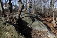
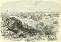
 Researchers have confirmed the site in Salem, Massachusetts, where 19 accused witches were executed by hanging between June and September of 1692. It’s called Proctor’s Ledge, a rocky, wooded area between Proctor and Pope Streets at the foot of Gallows Hill. As the name suggests, Gallows Hill was generally thought to be the place where the 19 victims were hanged, but it’s a big hill and the precise location has been subject of debate and study for many years.
While almost 1,000 documents pertaining to the trials have survived, making it one of the most thoroughly documented events in early American history, there are virtually no eyewitness reports of the actual hangings. The Proctor’s Ledge spot was first suggested as the hanging site by local historian Sidney Perley in a 1921 essay. Based on his research, in 1936 the city of Salem purchased a chunk of Proctor’s Ledge “to be held forever as a public park” dubbed “Witch Memorial Land,” but the park was never made and instead of being memorialized the hanging site fell down the memory hole.
 In 2010, the Gallows Hill Project was founded to re-investigate Perley’s research, examine other period documents and use new technology to pinpoint the site of the hangings.
Marilynne Roach discovered a few key lines of eyewitness testimony in a Salem witch trials court record…. The record in question is the examination of Rebecca Eames and Mary Lacey, dated August 19, 1692, the same day that five executions were carried out at the Gallows Hill site. The record quotes the defendant Rebecca Eames, who had been on her way to the court in the custody of her guards and traveled along the Boston Road, which ran just below the execution site.
A few hours later, she appeared the Salem court for her preliminary examination. The magistrate asked Eames whether she had witnessed the execution that took place earlier that morning as she was passing by. She explained that she was at “the house below the hill” and that she saw some “folks” at the execution. Roach determined that the “house below the hill” was most likely the McCarter House, or one of its neighbors on Boston Street. The McCarter house was still standing in 1890 at 19 Boston Street.
Professor Benjamin Ray conducted research that pinpointed the McCarter house’s location and worked with geographic information system specialist Chris Gist of the University of Virginia’s Scholars Lab to determine whether, in fact, it was possible for a person standing at the site of the house on the Boston Street to see the top of Proctor’s Ledge, given the rising topography of the northeastern slope of the hill. Gist produced a view-shed analysis, which determined that the top of Proctor’s Ledge was clearly visible from the Boston Street house, as well as from neighboring homes.
Geo-archaeological remote sensing on the site found that the ledge is almost entirely rock, with no more than three feet of soil in a few cracks. That means that the victims were not buried there, although they were buried somewhere nearby since as witches they were excommunicated and denied Christian burial in churchyards. There is also no evidence that there was an actual gallows erected on the site. The condemned were likely hanged from ropes slung over large tree limbs.
The city plans to go ahead with the memorial plan now, although it will have to be a modest marker since the spot is in the middle of a residential area with no clear public access or place for parking.
Did nobody think of warning the Injuns that if they let East Anglians settle, they’d soon be executing witches?
This is a topic that my students love coming back to, every year. The ghouls! I will add your post’s address to the reading list and will wait to see a photo of the memorial, once it is completed.
Thanks for the link
Hels
http://melbourneblogger.blogspot.com.au/2015/11/the-witches-of-salem-were-all-hanged.html
Strongly dissociate myself from this 17th century hometown haiku:
Tried to hang witches
With cosy trial hangings,
Recoursed to burning.
:hattip:
I did a little color correcting and cropping for desktop images. Museums sometimes are lazy in providing correctly colored files of their own paintings. I’m not saying my corrections are accurate, but they seem closer to what the original may look like.
https://www.flickr.com/photos/83082658@N00/23848572863/in/dateposted-public/