More than 30 early Iron Age houses found in South Tyrol

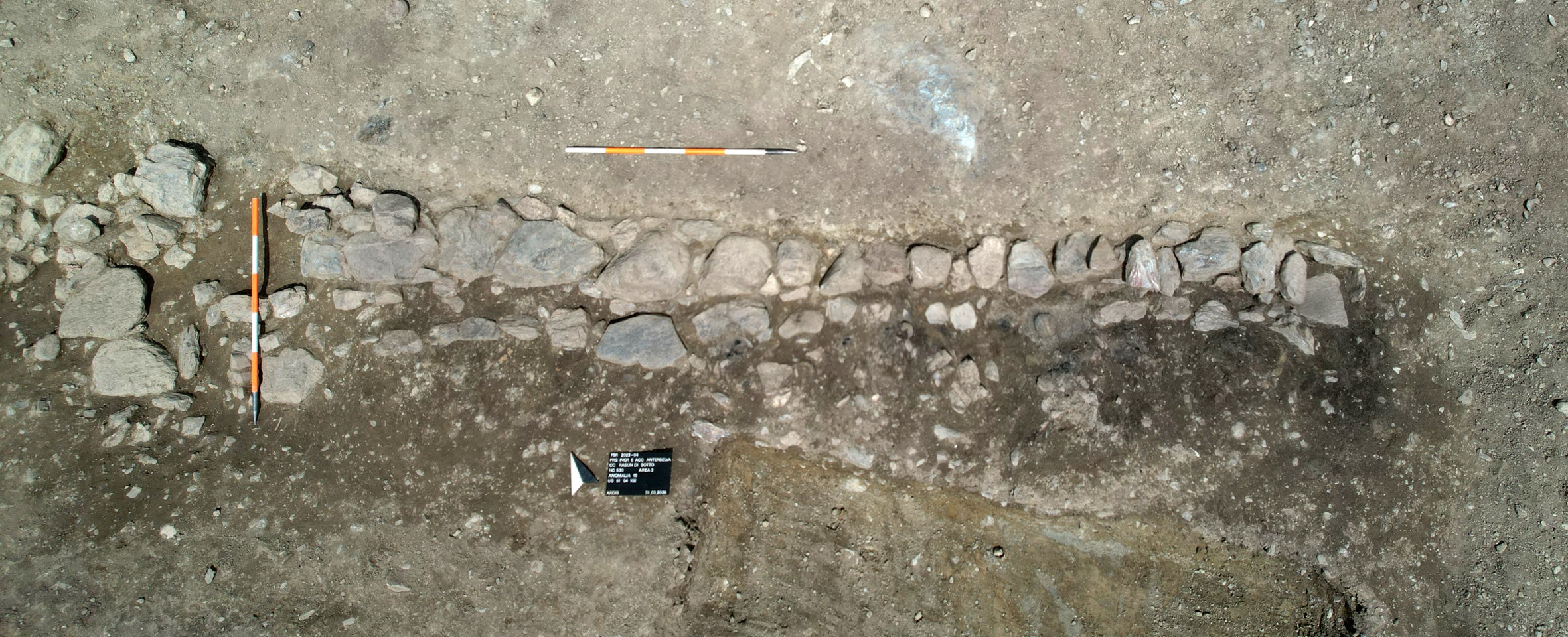
The remains of more than 30 dwellings from the early Iron Age have been unearthed at Galgenbichl in Italy’s autonomous Alpine region of the South Tyrol. They date to between 800 and 500 B.C. This is the first time a settlement of this size from this era has been archaeologically investigated, and it is now considered one of the most important early Iron Age sites in the Alpine region.

In late 2025, the regional Office for Archaeology began exploratory investigations along the routes of new highway access roads and excavations of sites with archaeological material began in February of this year. When the topsoil was removed from the Galgenbichl site, the remains of different types of dwellings were uncovered. On the steep slope of the hillside, houses were made with heavy stone foundations topped by a log structure. On the valley side, homes were raised on wooden piles.
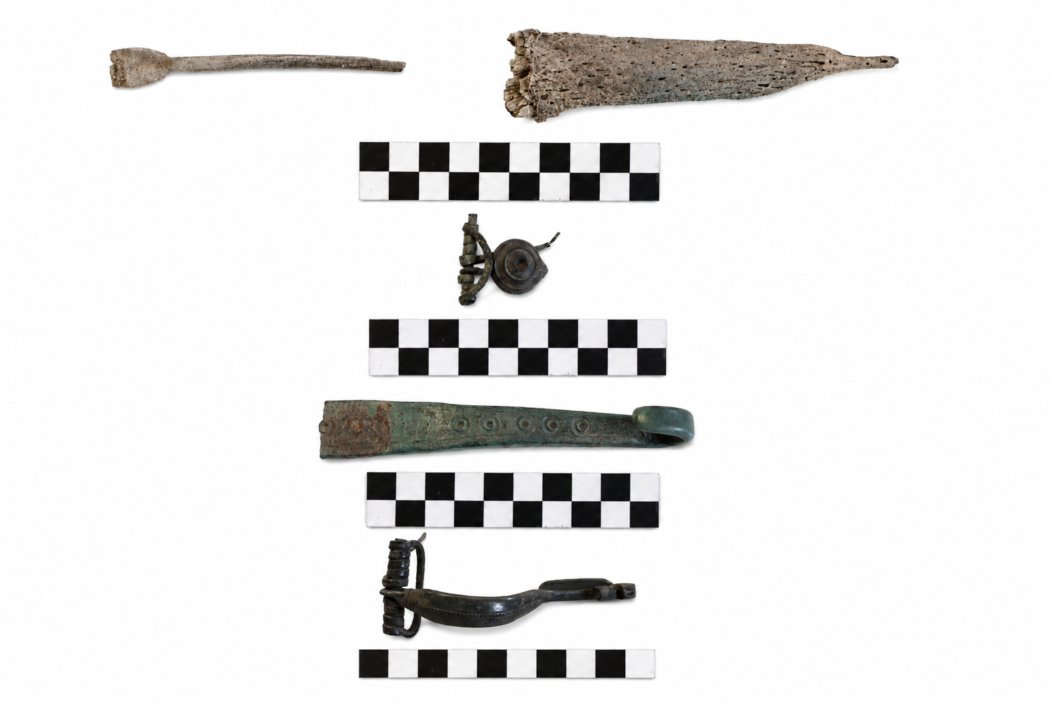
Artifacts unearthed at the settlement include fragments of everyday ceramic vessels, bones of domestic animals, particularly cattle, evidence of bronze working, loom weights and spindle whorls for the home production of textiles and millstones indicating grain was processed there. The preponderance of cattle bones suggest a relatively high standard of living for the period, as do the facilities for metalworking and the grinding of grain.

A remarkable discovery concerns the treatment of deceased children. Within the settlement, a small burial ground was found containing only infants. Unlike the nearby cremation cemetery in Windschnur (also in Niederrasen), these children were not cremated but buried directly within the settlement. This suggests that there were apparently special forms of farewell and remembrance for them. At the same time, the find serves as a reminder of how high infant mortality was at that time: many children did not survive their first year, with mortality rates ranging from 20 to 35 percent.

The settlement was located on the east-west axis through the Puster Valley, a strategically important link connecting the Venetii of northern Italy with the Raetians of what is now Switzerland. It continued to be populated until the 1st century B.C. By that time the area had changed from a Raetian community to part of the Celtic kingdom of Noricum, but continued to have strategic significance. Layers of charcoal and the charred remains of wooden beams from the pile homes point to the settlement having been destroyed by fire.
Celtic shield and weapon set found in Hungary

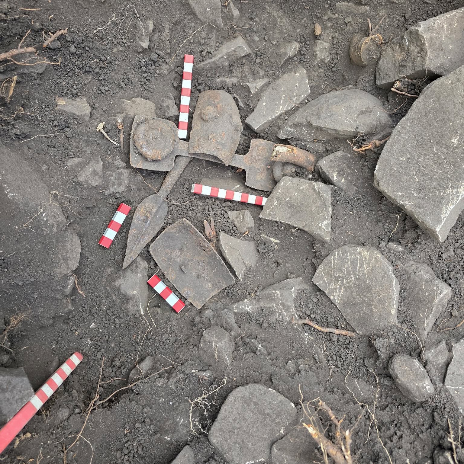
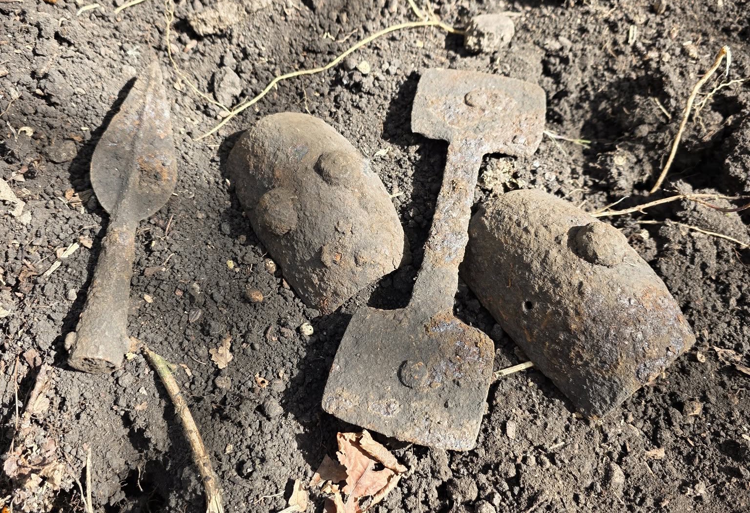
A rare set of Celtic shield fittings and spearhead has been discovered near the village of Erdőbénye in northeastern Hungary. It is the first of its kind from the region and will shed new light on Celtic communities in the area during the Iron Age.

Archaeologists and volunteers made the find during a community fieldwork as part of a multi-year project to systematically map known archaeological sites and identify previously-unknown ones in the Erdőbénye region. Led by archaeologists with the Hungarian National Museum, the community archaeology teams survey sites with metal detectors and excavate finds they encounter.

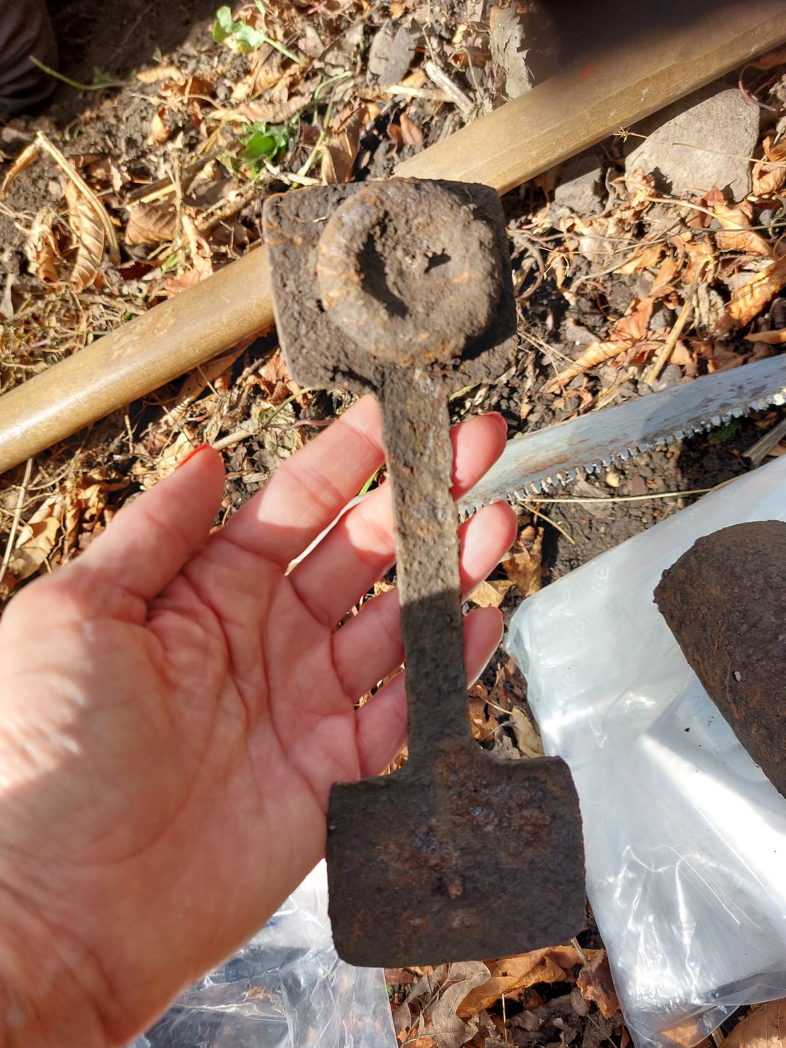
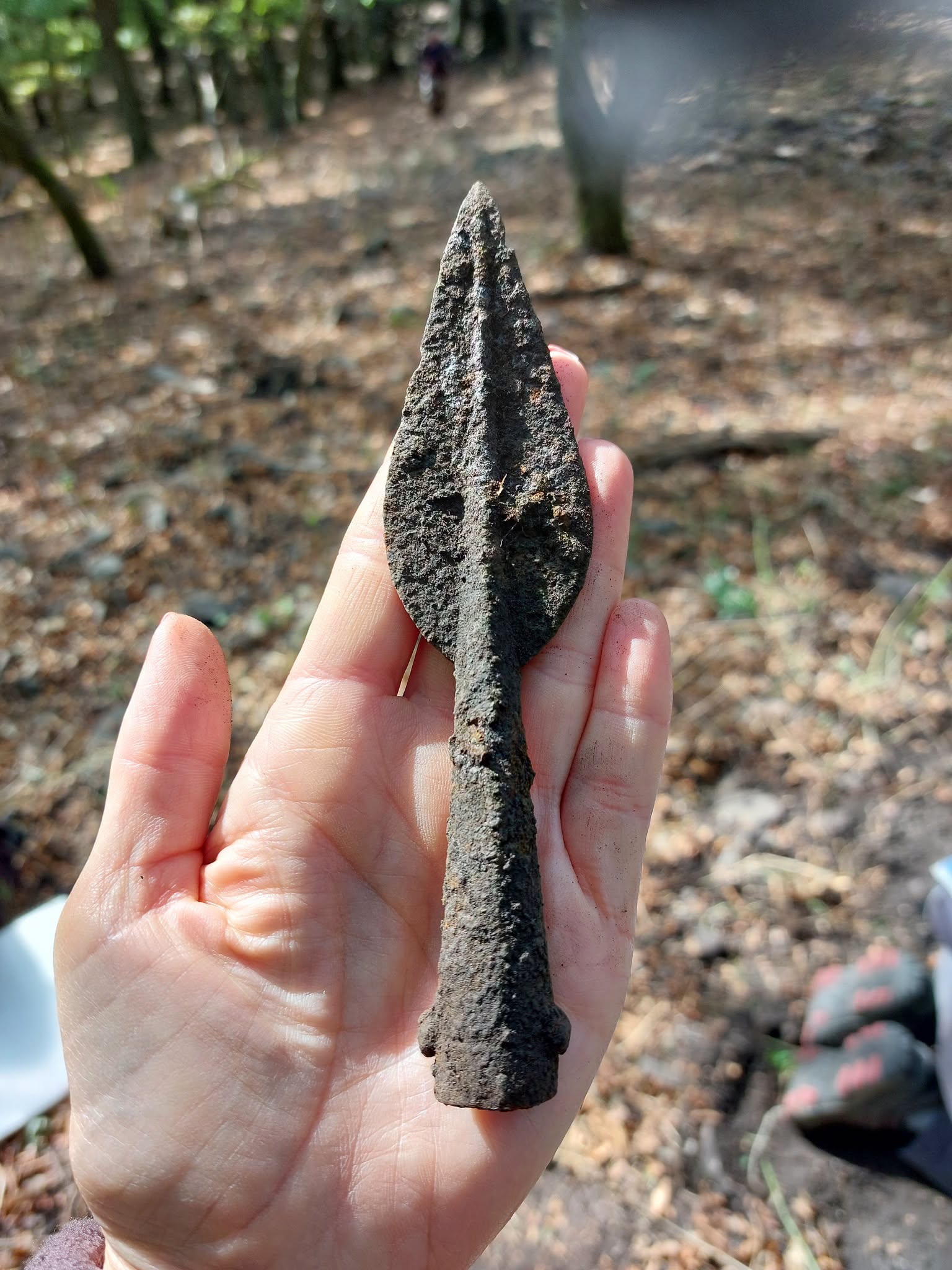
This September, the fieldwork uncovered a complete assemblage of shield fittings next to a spearhead. The shield fittings include the handle that would have been in the back of the wooden shield and a matched pair of decorative metals from the front of the shield. The shield parts and spear were deposited together deliberately, in the 4th or 3rd century B.C. when Celtic La Tène culture peoples were settling the Carpathian Basin including what is now Hungary. There were civilian communities established and sometimes it was not a peaceful process. Large-scale movement of Celtic peoples led to the first Sack of Rome in 390 B.C. and the invasion of Greece in 279 B.C.

Hungary’s location as the gateway to the Balkans from Central Europe made it a key route for the migrating Celtic peoples. Artifacts from the period found in Hungary, particularly ones that originated in the Mediterranean region, attest to how the settlers brought southern European culture to the area through trade, exchange of goods and military contact.

Roman sailor’s grave marker found in New Orleans goes on display in Italy

The National Archeological Museum of Civitavecchia officially reopened to the public on Thursday after a major renovation and redesign, and the repatriated funerary inscription of Roman navy soldier Sextus Congenius Verus is one of the featured artifacts. The information plaque credits Tulane University anthropologist Daniella Santoro and her husband Aaron Lorenz for the rediscovery of the slab in the backyard of their New Orleans home and its return to Italy.

The marble slab with the funerary inscription of a Roman sailor dating to the 2nd century A.D. made headlines last year when it was discovered so incongruously in the backyard of a historic shotgun house in the Carrolton neighborhood of New Orleans.

The Latin inscription translates to:

“To the spirits of the dead for Sextus Congenius Verus, soldier of the praetorian fleet Misenensis, from the tribe (natio) of the Bessi, (who) lived 42 years (and) served 22 in the military, on the trireme Asclepius. Atilius Carus and Vettius Longinus, his heirs, made (this) for him well deserving.”

The Praetorian fleet of Misenum and the trireme Asclepius were harbored and resupplied at the port of Centumcellae, the ancient name of Civitavecchia. It was a rectangular port on the Tyrrhenian sea 35 miles northwest of Rome built in 108 A.D. by Trajan’s architect Apollodorus of Damascus. It was one of the most important seaports in the western Mediterranean for hundreds of years.

Funerary inscriptions of many soldiers who served on the Misenum and Ravenna fleets have been discovered in Civitavecchia. A necropolis replete with them was unearthed during construction of a prison in 1864, the slab dedicated to Sextus Congenius Verus among them. For decades they were exhibited at the city’s National Archaeological Museum.

The ancient port (with later improvements and additions) was still in use during World War II, which made it a target for Allied bombing. The port and the museum were destroyed in bombing raids in 1943 and 1944. Sextus Congenius Verus’ inscription went missing. It was listed on an earlier inventory, but had not been seen since the museum was bombed in 1943.

After Tulane University Classics professor Susann Lusnia translated the funerary inscription and identified its origins in Civitavecchia, the slab was given to the FBI’s Art Crime Team to arrange repatriation. It was officially returned to Italy in a ceremony in Rome in April of this year. Conservators at the National Archeological Museum of Civitavecchia cleaned and prepared it for exhibition while the museum’s refurbishment project was completed.

Sextus Congenius Verus’ funerary marker is now part of a new permanent exhibition that creates a cohesive narrative of the 3,000-year-old history of Civitavecchia and its environs. Objects that have been in storage for decades are now in public view for the first time. The updated exhibition will also include new 3D models, multimedia displays and accessibility tools to make the archaeological patrimony of Civitavecchia widely accessible to visitors of all abilities.

Roman-era pyramid tomb with Greek stele found in Egypt

A Roman-era tomb in the shape of a small pyramid has been discovered in the Dakhla Oasis of Egypt’s Western Desert. The tomb is a combination of Egyptian, Greek and Roman cultural and funerary traditions.

The tomb was found at Bir al-Shaghala, part of the necropolis of the ancient city of Mut, capital of the oasis in the Ptolemaic and Roman periods. One of seven major oases in Egypt, Dakhla covers 770 square miles in the deep desert about 465 miles southwest of Cairo and has been continuously inhabited for more than 2,000 years. The tomb is about 1,700 years old.

It was built with mud bricks arranged in a pyramidical shape, but unlike its monumental pharaonic inspirations, the tomb was small, intended to hold the remains of one husband and wife. Fourteen steps lead down to the entrance to the tomb: a sandstone doorway built in classic dynastic Egyptian style and carved with the iconography of the traditional Egyptian religion. A winged sun disk flanked by two cobras and bracketed by bundles of papyrus reeds was carved on the cornice, while funerary spells in hieroglyphic texts were carved on the door jams to guard and protect the deceased on their journey to the underworld. The entrance was sealed with a heavy block of stone engraved with the god Osiris and more hieroglyphic protective spells.

The stand-out feature among the funerary reliefs is on the lintel stone above the doorway. It depicts the sun god Ra’s nocturnal journey through the underworld as described in the Amduat, an important funerary text from the New Kingdom that was discovered carved on the walls of the tombs of pharaohs. It was exclusively used for pharaohs and very few select high officials until the 21st Dynasty (1077-943 B.C.).

This is the first time the Amduat scene has been found in the necropolis, and it is an extraordinary testament to the longevity of traditional pharaonic religion in Egyptian culture even after many centuries of Ptolemaic Greek and Roman rule.

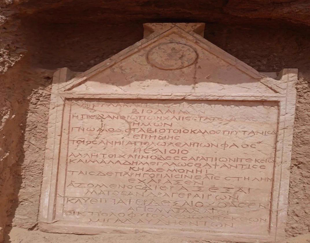
Inside the tomb is a mudbrick hall under a vaulted roof. The roof had partially collapsed. Two burial chamber built of mud brick coated with mortar were on the right side of the hall, and the pyramid structure was built above them. Embedded in the south wall is a funerary stele with a funerary poem in Greek painted in red letters. It is 19 lines long and dedicated to one Pisechtes who may have been a judge. It dates to the late 3rd or early 4th century.

The excavation also uncovered a sandstone offering table positioned above a sandstone purification basin, a collection of pottery vessels, and a bronze coin bearing a relief depiction of the Roman Emperor Constantine.

Archaeologists also found evidence suggesting the tomb may have been reused later. A mudbrick chapel was discovered above the main entrance, with a funerary shrine in front of it consisting of four square mudbrick columns. […]

Hisham El-Leithy, Secretary-General of the SCA, said the tomb’s architectural features, inscriptions and funerary texts provide important information about funerary practices and the cultural and religious life of the Dakhla Oasis during the Roman period.

Ancient wall may be earliest Gallic remains of Paris

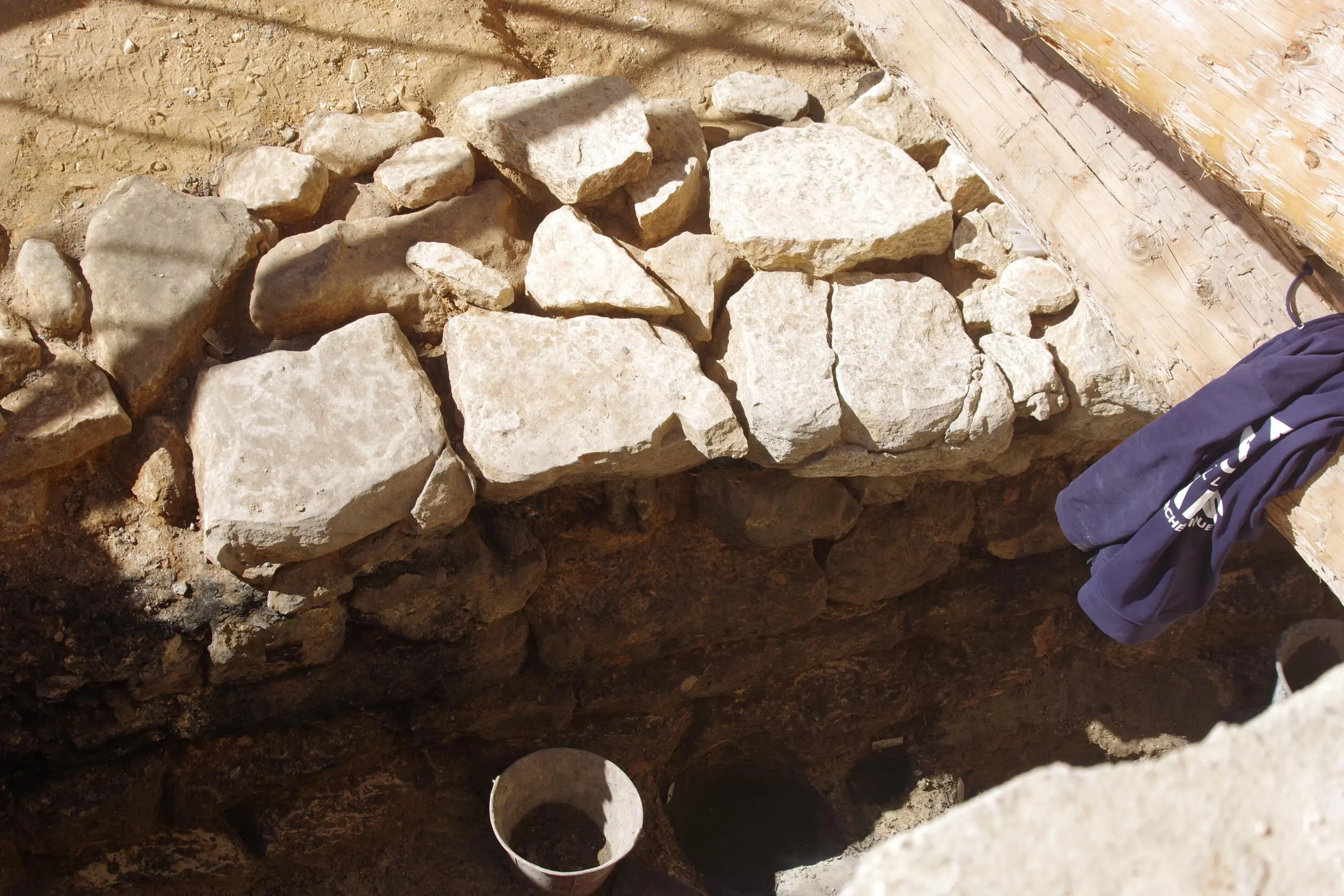
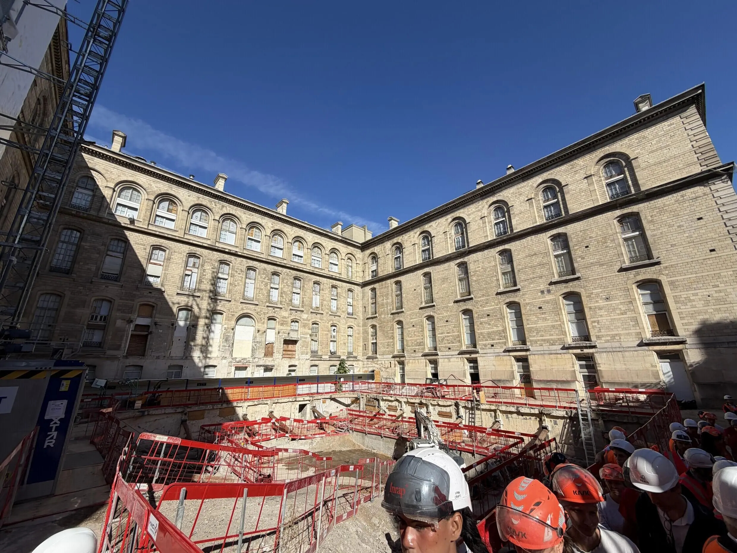
The remains of an ancient Gallic stone and wood wall have been discovered beneath a the 19th century Hôtel-Dieu hospital on the Île de la Cité, the island in the Seine River that is in the heart of the modern city of Paris. Île de la Cité has long been hypothesized to have been the site of Lutetia, the first Gallic oppidum that would become Paris. Before this discovery, no traces of a pre-Roman settlement had been found on the island, and scholars have debated other possible locations as the original Lutetia.

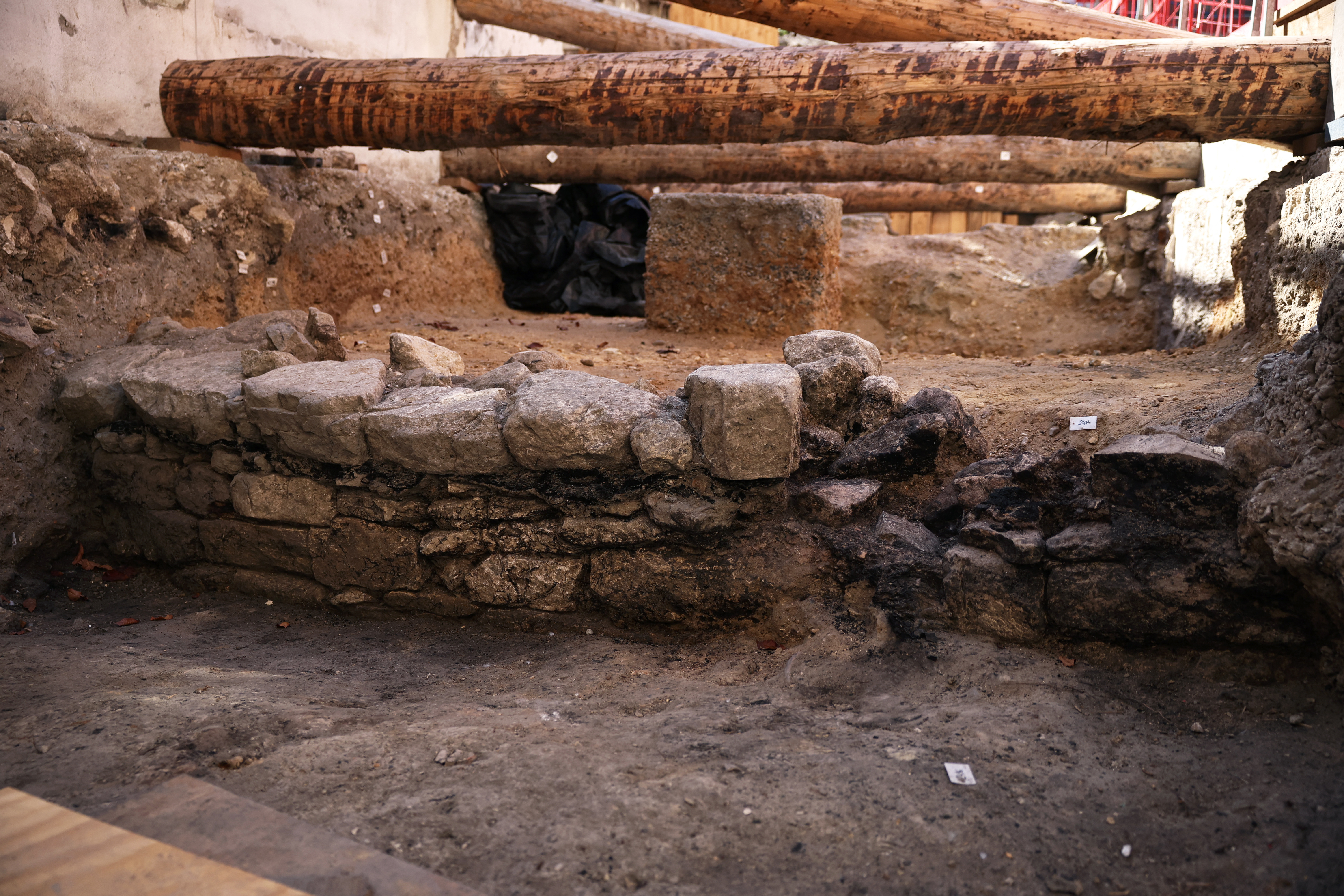
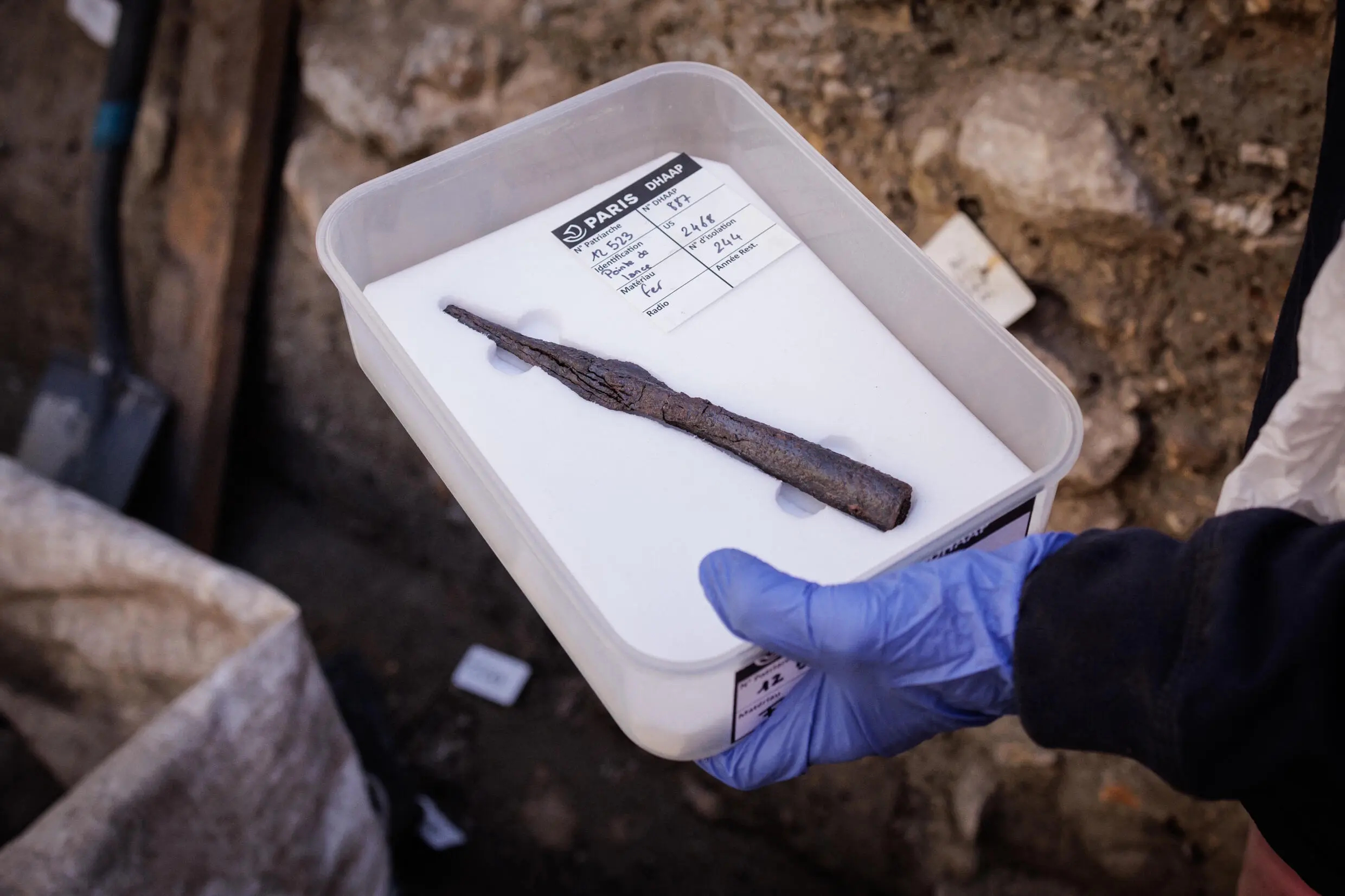
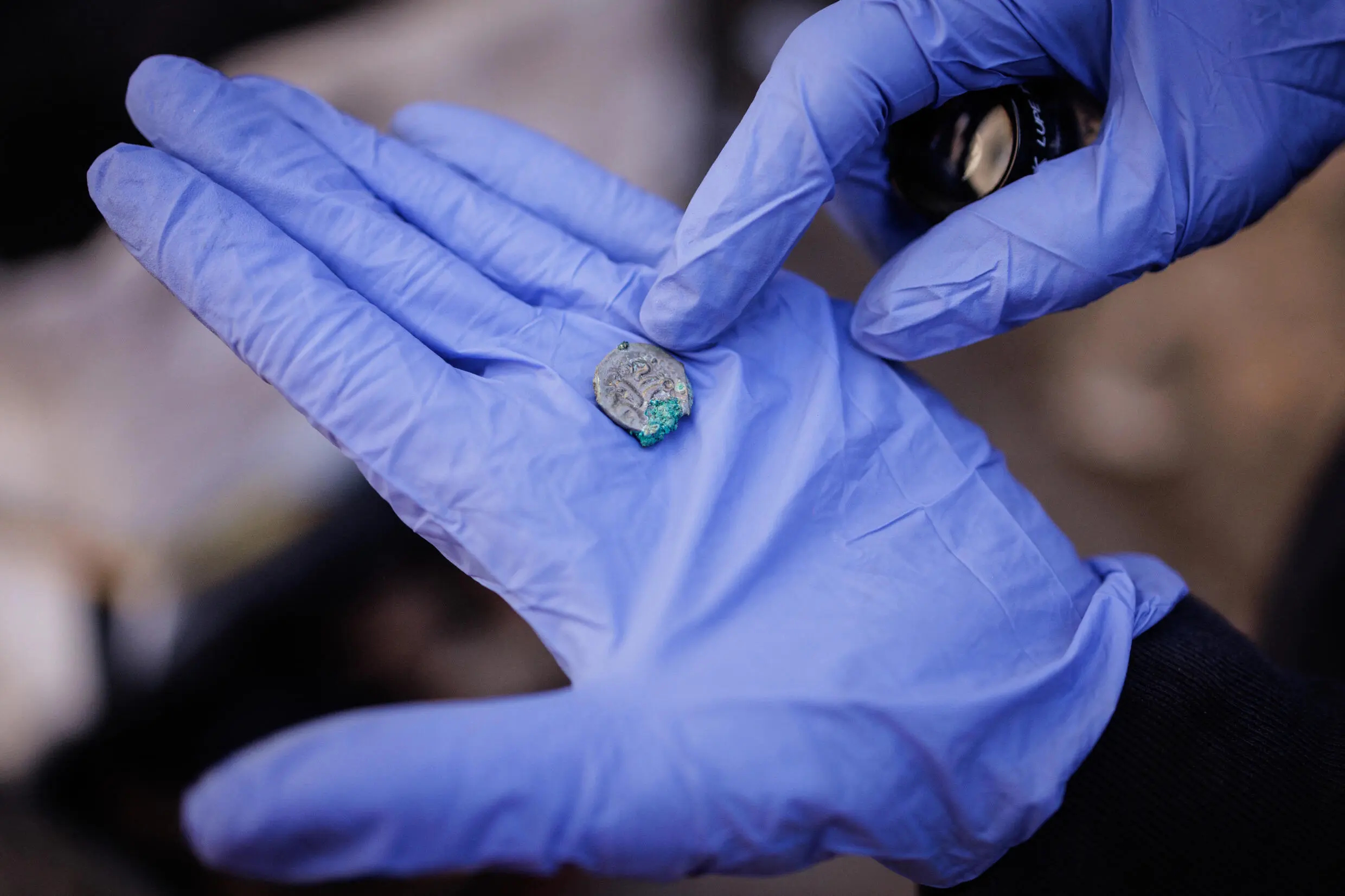
The 65-foot section of wall was discovered in an archaeological survey during construction work in the courtyard of the Hôtel-Dieu hospital. The wall is made of stone blocks with horizontal wooden beams, a technique typical of fortifications of late Iron Age Gallic oppida. Behind the wall was a platform created with piled sand and gravel almost seven feet thick. Archaeologists found a Gallic spearhead and a coin at the base of the platform.

Traces of severe burning were discovered on the wall cladding. There were also charred seeds found near the wall, and the remains of a burned wooden structure right in front of it. Carbon-14 testing of the charred wooden elements date them to between 200 B.C. and 10 B.C., a range which comfortably includes 52 B.C., the year when according to Julius Caesar, the Gallic Parisii tribe set fire to their oppidum to keep it out of the hands of the invading Romans.

The first written account of Lutetia is in the seventh commentary of Julius Caesar’s Commentaries on the Gallic War, and it is bare bones: “This is a stronghold of the Parisii, situated on an island in the River Seine.” Caesar describes how while he took his legions to fight the Aedui and rescue his supplies by fording the Loire River, his lieutenant Titus Labienus took four legions to Lutetia. When they heard how he’d defeated Senones in Metiosedum by making a bridge out of ships, the Parisii burned Lutetia and broke up its bridges before he arrived.

There are several islands in the Seine, so this description didn’t really narrow down the location of the original Gallic settlement that would become Paris, and while Île de la Cité was a likely candidate, other possibilities caught scholars’ eyes, most recently the Parisian suburb of Nanterre at a bend in the Seine where a large Gallo-Roman necropolis was excavated between 1994 and 2005.

After the Roman conquest, Lutetia regrew mostly on the Left Bank of the Seine where some of the most ancient finds in Parisian history have been made. After the town was sacked by Germanic tribespeople in the late 3rd century, Île de la Cité was fortified and became a bulwark of defense against invasion. The Roman governor lived there in the 4th century. The first Frankish king, Clovis I, established his capital in Paris in 508 A.D., and built his palace on Île de la Cité.

The first hospital was built on the island in 651 A.D., so while the current Hôtel-Dieu building was completed in 1877, it has ancient antecedents, but nobody expected to find a structure 800 years older than the first hospital under its courtyard.

Because of the exceptional significance of the find, excavations will continue to unearth the entire complex of structures that remain. Archaeologists will study the wall to establish its purpose, the construction date, the circumstances of the destructive fire and what the connection between the wall and the sand and gravel platform behind it is.

The wall is not likely to be preserved in situ. It is deep below ground level and in an exceptionally fragile condition due to the fire. The plan is to make a mold of the wall so that it can be reconstructed after conservation in a museum. It will be thoroughly documented, scanned, photographed with thousands of HD pictures to create a digital photogrammetry composite.