 A team from the University of Sydney’s Australian Centre for Asian Art and Archaeology has discovered a previously unknown city from the early Khmer Empire on Phnom Kulen mountain, 25 miles of Angkor Wat, Cambodia. Archaeologists knew that there were a few scattered temples on the site because the ruins are still visible through the jungle growth, but when they attached Lidar to a helicopter and then flew over the area for seven days, the remote sensing technology revealed much more than a handful of isolated temples.
Lidar, a portmanteau of laser and radar, points a laser beam at a target and then determined distances by analyzing the reflected light. It’s a highly effective (and highly expensive) tool for mapping architectural features hidden underneath thick jungle canopies. What the Lidar found was more than two dozen new temples, plus canals, roads and dykes indicating the site was a major city complex. Many of the temples are invisible to the naked eye and show no sign of having been interfered with by looters, a rare boon to archaeologists.
In effect the Lidar technology peeled away the jungle canopy using billions of laser pulses, allowing archaeologists to see for the first time structures that were in perfect squares, completing a map of the city which years of painstaking ground research had been unable to achieve.
The archaeologists were amazed to see that 36 previously recorded ruins scattered across the mountain were linked by an intricate network of gridded roads, dykes, ponds and temples divided into regular city blocks.
 The team believes these structures belong to the ancient city of Mahendraparvata, the capital built by the founder of the Khmer Empire, Jayavarman II. Scriptures describe a great ceremony held by Jayavarman II on Phnom Kulen mountain in 802 A.D. to celebrate Cambodia’s freedom from Javanese control. He was proclaimed God King at this ceremony and built a city on the sacred mountain and ushered in the glories of the new Angkor era. Angkor Wat was built more than 300 years later in the 12th century.
Like Angkor Wat, the Mahendraparvata city grid is oriented east-west and north-south, but Angkor Wat was built on a flat plain while Mahendraparvata was built on a mountain side. Clearing the area of vegetation and building in neat geometries was an exceptional feat of engineering for the newborn empire. That deforestation may have been an important contributing factor to the demise of the city because stripped of its natural ecology, the city became dependent on water management systems which could not support its population as it grew.
 Much more investigation much be done before the question of what happened to Mahendraparvata is answered. Archaeologists believe the Lidar only covered the tip of the iceberg over those seven days. They think the city is far vaster and they want to return with a more extensive Lidar exploration. It’s an expensive proposition so they’ll need to raise funds before they come back with more Lidar, but in the meantime they have a rich new archaeological site to explore the old-fashioned way.
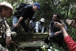
Here’s a video of them tramping the jungle, looking for the structures revealed in the Lidar data. Watch the whole thing because it’s amazing to see just how little of the archaeology can be seen with the naked eye. One of the temples is under a rice field and there is exactly one partial brick on the surface testifying to what’s underneath.
The gentlemen they used as guides are local men; won’t they go home, tell their families what was found, and give the looters a high-tech head start on taking everything of value? I don’t see the Cambodian government having the resources or inclination to put armed guards on duty 24/7 over an area several hundred kilometers in extent. I realize they needed some evidence to get more funds, but maybe a little more discretion was in order?
That’s exactly what I was thinking.
Crowing about how it hadn’t been looted and then posting a detailed map on :confused: line.
And the price of gold these days…….
alright guys keep it up