Visit Henry III’s toilet at restored Clifford’s Tower

Clifford’s Tower in York is the only structure remaining from York Castle. The original structure on the site was a timber Norman motte-and-bailey castle built by William the Conqueror in 1068. The wooden keep was burned down in 1190 in a horrific anti-Semitic riot where the 150 members of York’s Jewish community had barricaded themselves inside the tower from the wrath of the mob. Under violent attack from knights, a siege engine and the rioters, the Jews inside the keep killed themselves and set fire to the tower. The few who opted out of suicide and managed to escape the tower were massacred by the mob.

The present Clifford’s Tower was constructed on the ashes of this tragedy. Reconstruction began in the early 13th century, but the new stone keep would not be completed until the end of the century. York Castle would mainly be used for administrative purposes — prison, mint, briefly as headquarters of the Exchequer — not as an actual royal residence. It was not well-maintained. Accounts from the 15th century already report some of the buildings were in ruins, and there was a scandal in the 1590s around the gaoler of the castle purportedly trying to demolish the tower to sell the stone.

Clifford’s Tower saw real action in the English Civil War. Queen Henrietta Maria had it restored and a new wood roof put on in 1643 just in time for it to be taken by Parliamentarian forces in 1644. After the Restoration, the tower was garrisoned by troops who were notorious carousers. On April 23, 1684, they fired a ceremonial salute indoors and set the place on fire again. The fire gutted the wooden interiors and Henrietta Maria’s roof and the tower fell to ruin. Occasionally people used it as a stable or barn.

Finally it became property of the state in the 1915 and it was repaired and stabilized in the 1930s so it could be opened to the public for the first time in centuries. It was sort of a look-in attraction, however, a 15-minute visit at most to walk up the stone circular staircase to see some great views of York, including the Minster. There was no signage to speak of, limited information panels, and nothing to do inside but look up at the sky.

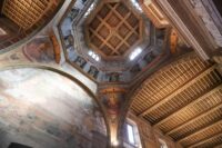
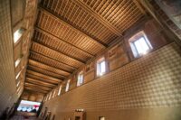
Now English Heritage has invested £5 million in a total transformation of the tower’s interior. Timber stairs and hanging walkways criss-cross up the tower walls, giving visitors access to long-hidden spaces like Henry III’s garderobe, ie, his toilet. It was a high-tech bathroom in the 13th century, complete with a built-in toiletries cupboard, a flushing spout that ran water down the lavatory hole all the way down and out the tower. Visitors who Escher their way up the walkways will reach the new roof deck with spectacular views of the city.

The new interior and roof deck at Clifford’s Tower has been designed by Hugh Broughton Architects, a leading contemporary architectural practice. Supported by four slender wooden columns, the ingenious structure sits on a raft foundation, which spreads the load without impacting on the archaeological remains beneath the tower. The practice has worked closely with conservation specialists Martin Ashley Architects to produce a scheme which sits respectfully within the heritage structure.

New interpretation will help place the tower in the context of both the historic York Castle and the city of York itself as well as introducing visitors to the tower’s long and turbulent history. Visitors can explore the castle’s founding by William the Conqueror, the tower’s role as the site of the tragic 1190 massacre and suicide of York’s Jewish community – one of the worst anti-Semitic episodes in English history – and the role of the castle as both a medieval royal stronghold and a garrison during the Civil War.

Integral to the new scheme is its soundscape. Layers of background sound will take visitors back in time, allowing them to experience the tower as it would have been at various periods in its long history. Visitors can engage with five key moments in that history with the help of the voices of local residents who bring the stories of fictional characters to life, each representing a different chapter in the tower’s past.

Clifford’s Tower reopens Saturday, April 2nd. Here’s some cool drone footage of the new roof deck:

Fra Mauro world map digitized to the nines

The visionary world map created by 15th century monk Fra Mauro has been digitized and can now be explored in detail online with a fantastic depth and breadth of explanatory material in Italian, English and Chinese.

Made in the monastery of San Michele in Isola around 1450, the map took a whole new approach to cartography, eschewing the purely symbolic representations of a world centered on Jerusalem or Rome common in medieval European maps before then. It is based on the Geography of Ptolemy and contemporary marine charts, and includes thousands of annotations derived from ancient sources, medieval scholars, explorers like Marco Polo and Niccolò de’ Conti and eye-witness reports Fra Mauro got from travelers to Venice and visiting Ethiopian monks. It is brilliantly illuminated, densely packed with iconographic imagery representing cities, castles, roads, ships, even shipwrecks. Leonardo Bellini, illuminator and nephew of famed painter Jacopo Bellini, painted an image of the Garden of Eden in one corner.

The map was displayed at the monastery — initially in the church itself — and rapidly became an icon of Venice’s status as a flourishing center of global commerce and art.  It stayed there for 350 years until the suppression of monasteries under Napoleon in 1810 when it was transferred to the city of Venice. It is now part of the permanent collection of the Biblioteca Nazionale Marciana.

The digital edition of Fra Mauro’s world map embraces its creator’s embrace of data abundance. A collaboration of the Galileo Museum in Florence, the Marciana National Library and the Nanyang Technological University in Singapore, the map can be explored virtually in as little or as much depth as you’d like. Click section 2 to focus in on the interactive map and click around at your discretion, but fair warning: it is an overwhelming amount of information to absorb. I highly recommend starting at the beginning with the introduction and clicking through the sections in order.

Just to give you a quick glimpse of the density of content here, check out one single menu item, the cartouches in the Geographic Space category. It highlights, transcribes and translates every one of the 2,922 cartouches that describe cities, countries, regions, bodies of water, roads, bridges, trade routes and so much more. Scroll down the menu a little further to explore Marco Polo’s travel itinerary linked with the contemporary locations on Google Maps.

Most of the menu selections have interactive audio and video. Just click on the play buttons to launch detailed explanations of what you’re seeing. (I found the Legendary Places view entertaining). Subsequent sections contextualize the map, its significance at the time, how it was reproduced, its place in a timeline of other illuminated world maps (all of which are also digitized in high resolution so you can hunt through even more medieval cartography) and the enormous influence of Ptolemy on the world map. Fra Mauro’s Marine Chart gets its own dedicated section.

Last but certainly not least is a Digital Library that makes my nerdy heart go pit-a-pat. Every entry is a book about geography and travel hyperlinked to a digitized version of the tome in question. The digitization truly redefines deep dive.

Medieval St. George seal matrix found in French château

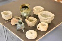
A previously unpublished and unknown bronze seal matrix of Saint George slaying the dragon has been discovered at the royal Château of Villers-Cotterêts in northern France. George’s armor stylistically dates the piece the early 15th century.

The chateau was built in 1528 by King Francis I. Its greatest fame comes from having been the location where King Francis I signed the Ordinance of Villers-Cotterêts, the edict that replaced Latin with French in all official acts of law and government, in August of 1539. It is the oldest French law still in force in French courts today.

Archaeologists have been excavating the royal estate since 2020. The seal was discovered in a coal pouch in a room in the north wing of the castle. Seal matrices were extremely important in the Middle Ages, the sole means of confirming the authenticity of a signature, and as such were customarily destroyed or buried with the owner after death. For one to be tossed in with the coals it was almost certainly lost by accident, perhaps by someone warming himself at a fireplace, and was inadvertently discarded with the ashes by staff.

The seal matrix is circular with a pierced mount on the back from which the seal could be worn on a chain around the neck or tied to a belt. It is hollow engraved on the obverse with a mounted horseman in full plate armor. Under the legs of the rearing horse is a dragon. It is bordered with a beaded edge and inscribed “IP PRI/EUR / DEVILLERS / LESM / OINE”.

The inscription indicates the seal belonged to the prior of the Saint George monastery in Villers-les-Moines which was a half-mile stroll from the Chateau of Villers-Cotterêts. Very little is known about this priory, which makes the discovery of the prior’s seal even more historically significant.

14th c. lead sarcophagus found under Notre Dame

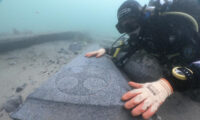
A lead anthropoid coffin from the 14th century has been discovered under Notre-Dame de Paris. Archaeologists unearthed the sarcophagus in the very heart of the cathedral where the transept and nave intersect, so the individual buried there must have been someone of importance, likely a church dignitary. Notre-Dame was the final resting place of several prominent individuals, but this is the first time a well-preserved intact sarcophagus has been found.

The area is being excavated archaeologically prior to the installation of massive scaffolding 330 feet high that will be used in the reconstruction of the spire that was so wrenchingly burned to the ground in fire that devastated Notre-Dame on April 15th, 2019. Archaeologists and scientists dug under the nave-transept intersection point to ensure the ground and subground are structurally sound enough to support the spire during and after construction.

The sarcophagus was found in the middle of a network of brick heating pipes from the 19th century. Apparently they added the pipes working around the sarcophagus. The soft lead had been dented by the weight of soil and stones on top of it, but it is overall in excellent condition. A mini endoscopic camera threaded into the sarcophagus confirmed that the contents are as well.

“You can glimpse pieces of fabric, hair and above all a pillow of leaves on top of the head, a well-known phenomenon when religious leaders were buried,” said Christophe Besnier, the lead archaeologist.

“The fact that these plant elements are still inside means the body is in a very good state of conservation,” he added.

Its discovery will help improve our understanding of funeral practices in the Middle Ages, added Dominique Garcia of the National Institute of Archaeological Research.

A few feet away from the sarcophagus at the foot of the choir, archaeologists discovered the broken remains of the old rood screen, the partition between the chancel and nave that was a common feature in churches of the late Middle Ages. Notre Dame’s rood screen was carved of stone and featured numerous statues painted in bright colors. It was built in 1230 and remained in place until the early 18th century, even though rood screens fell out favor in the mid-16th century when the Council of Trent required that Mass be made more accessible to the congregation. A heavy physical barrier blocking worshippers’ view of the altar was no longer on policy.

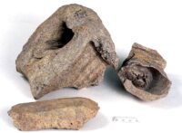
The screen was demolished, but it seems the crew did not believe in a keeping a clean workspace because archaeologists have found numerous fragments of stone from the screen, and larger pieces including the head of bearded man, vegetable accents and two clasped hands.

Pictish symbol stone found near famous standing stones

Archaeologists have unearthed a rare Pictish symbol stone dating to the 5th or 6th century in the village of Aberlemno, Scotland. Aberlemno is known for a group of Pictish and Early Medieval standing stones, the most famous of which depicts a clash of armed infantry and cavalry forces believed to have been the Battle of Nechtansmere where the Picts defeated the Northumbrians in 685 A.D., ending Northumbrian control of Scotland once and for all.

University of Aberdeen archaeologists discovered the slab during a geophysical survey of the site as part of a larger study of the context of the Aberlemno Sculptured Stones. The scans revealed the presence of anomalies that might be connected to an ancient settlement. The team dug a small test pit and almost immediately encountered a slab 5.5 feet long lying on its back. As the soil was removed, Pictish symbols were revealed.

The large stone is incised with a variety of symbols, including the mirror and comb, a crescent, V-rod, triple ovals and the double disc and z-rod designs. Next to it was another slab carved with cup-markings typical of prehistoric symbol stones. These were sometimes reused by the Picts who would add their own carvings to the far more ancient monuments. This was likely a deliberate choice reflecting Pictish understanding of the symbolic significance of their Bronze Age predecessors’ rock art.

The stone was embedded in a pavement that was part of a building from the 11th or 12th century, so it was not in its original location like the other standing stones of Aberlemno. There is evidence that the later medieval building was constructed directly above far older settlement layers going back to the Pictish era.

Professor Gordon Noble who leads the project says stumbling upon a stone as part of an archaeological dig is very unusual.

“Here at the University of Aberdeen we’ve been leading Pictish research for the last decade but none of us have ever found a symbol stone before,” he said.

“There are only around 200 of these monuments known. They are occasionally dug up by farmers ploughing fields or during the course of road building but by the time we get to analyse them, much of what surrounds them has already been disturbed.

“To come across something like this while digging one small test pit is absolutely remarkable and none of us could quite believe our luck.

“The benefits of making a find in this way are that we can do much more detailed work in regard to the context. We can examine and date the layers underneath it and extract much more detailed information without losing vital evidence. […]

“The discovery of this new Pictish symbol stone and evidence that this site was occupied over such a long period will offer new insights into this significant period in the history of Scotland as well as helping us to better understand how and why this part of Angus became a key Pictish landscape and latterly an integral part of the kingdoms of Alba and Scotland.”

The stone was lifted and transported to the to Graciela Ainsworth conservation lab in Edinburgh for additional study. The University of Aberdeen will work with the Pictish Arts Society to raise funds for the symbol stone’s conservation and eventual display.