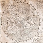
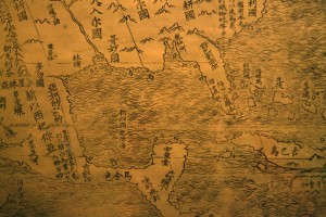
One of the rarest of all maps, the Ricci World Map of 1602, is going on display as part of the Library of Congress’ “Exploring the Early Americas” map exhibit. Unveiled today, it will remain there until April 10 when it will move to the Minneapolis Institute of Arts for a short exhibit, then to its permanent home, the James Ford Bell Library at the University of Minnesota.
 This map is one of only two in good condition. Its rarity, important representation of the meeting of East and West and its Chinese annotations have earned it a lovely romantic moniker among collectors: the Impossible Black Tulip. There are a handful other copies in the Vatican library, in a private collection in France and in public collections in Japan.
This particular copy was sold by a Japanese collector to the the James Ford Bell Trust for a cool million dollars, the second highest price ever paid for a map. The highest price is $10 million, paid by the Library of Congress for the 1507 Waldseemüller World Map, the first to use the name “America”. The Waldseemüller map is currently on display right next to the Ricci in the Library of Congress exhibit.
 The Ricci World Map was drawn by Jesuit missionary Matteo Ricci at the request of Emperor Wanli. It’s the first Chinese map to show the Americas, and it’s huge with all kinds of detailed annotations. The notes next to North America mention “humped oxen” (aka bison) and the northernmost “Ka-na-ta” region. It’s composed of six rice paper panels totaling 5.5 feet in height, 12.5 feet in width. The panels were designed to be mounted on a folding screen.
Although Ricci never actually met the Emperor, he did impress him enough with a gift of a chiming clock that in 1601 he became the first Westerner ever invited into the Forbidden City. When he died in 1610, the Emperor granted him a special dispensation to be buried in Beijing rather than in Macao where all foreigners were by law to be buried.
Unfortunately this is the biggest picture I could find of the entire map, but the Library of Congress plans to upload detailed images of it to its excellent site after the exhibit is over.
