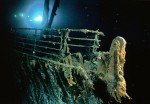
 On August 18th, a collaborative team from RMS Titanic Inc., the company that has salvage rights to the wreck of the Titanic, and the Woods Hole Oceanographic Institution will be returning to the wreck site not to recover artifacts, but to probe the entire debris field with the eventual goal of creating a 3D virtual rendering of exactly what is left of the ship 2.5 miles under the North Atlantic.
It’ll be the first time the wreck is recorded like an archaeological site instead of explored for salvage booty (and to make the incredibly crappy intro of an incredibly crappy movie out of the underwater footage). The careful mapping will contribute greatly to our understanding of the historical Titanic and will also pinpoint the wreck’s current state of preservation. The plan is to share the virtual rendering with the public once it’s complete.
The “dream team” of archaeologists, oceanographers and other scientists want to get the best assessment yet on the two main sections of the ship, which have been subjected to fierce deep-ocean currents, salt water and intense pressure.
Gallo said while the rate of Titanic’s deterioration is not known, the expedition approaches the mission with a sense of urgency.
“We see places where it looks like the upper decks are getting thin, the walls are thin, the ceilings may be collapsing a bit,” he said. “We hear all these anecdotal things about the ship is rusting away, it’s collapsing on itself. No one really knows.”
The expedition will use imaging technology and sonar devices that never have been used before on the Titanic wreck and to probe nearly a century of sediment in the debris field to seek a full inventory of the ship’s artifacts.
“We’re actually treating it like a crime scene,” Gallo said. “We want to know what’s out there in that debris field, what the stern and the bow are looking like.”
The expedition will be based on the RV Jean Charcot, a 250-foot research vessel with a crew of 20. Three submersibles and the latest sonar, acoustic and filming technology will also be part of the expedition.
They will also take samples of the iron hull, which they hope will answer some questions about how the ship went down. The 3D mapping of the debris field will also provide new information about what happened the night of April 14, 1912. Scientists will be able to examine in detail parts of the ship that haven’t been seen before because they’re jammed into the mud on the seafloor.
The pictures the team retrieves from the submarines will be compared to the pictures taken on RMS Titanic’s first expedition to the wreck 25 years ago. They’ll be able to gauge the rate of decay over that period, and continue to gather data that might be key to conservation on future mapping expeditions.
RMS Titanic, Inc., is still working on a website dedicated to the expedition, but they already have a Facebook page up where you can ask questions and follow the expedition.
are you stupid?
there is no reason to bring it up cause
it’s so old it would just fall apart
especially the stern which unfortunately
is in much more termoil then the bow.
but keep loving the TITANIC ship anyways
cause then it will never die! :skull:
The Titanic is a major historical artifact. Historians and anthropologists dig up graves all of the time for the historical value.
There is more to this debate than TITANIC VICTIM attempts to let on.
🙁 This always makes me so sad.
Thanks for the photos and info
:no: SO SAD