Galloway Viking Hoard Campaign launched

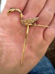
A new campaign has been launched to keep the Galloway Viking Hoard for exhibition in the county where it was found. Buried in the 10th century, the hoard was discovered by a metal detectorist in field near Castle Douglas in Dumfries and Galloway, Scotland, in September of 2014. Archaeologists excavated the hoard and found more than 100 silver and gold pieces, from ingots to jewelry to fragments of Byzantine silk to an extremely rare Carolingian pot stuffed with more treasure. The Galloway Viking Hoard is the largest Viking treasure found in Scotland since 1891.
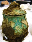
Since then, the Carolingian pot CT has been scanned and painstakingly excavated in the laboratory and the other objects cleaned and stabilized, but there’s still much more to be learned from this unique assemblage of artifacts. Bordered by the Cumbria, with its high Norse population, to the south, and the Viking-dominated Irish Sea to the west, Galloway had a strong Viking presence from the 9th until the 11th century. The person who buried the hoard was almost certain Norse, burying his or her most precious valuables, many of them heirlooms, handed down spoils from long-ago raids on Anglo-Saxon, Irish French and/or German communities. No other Viking hoard has been found with such a wide variety of objects — gold, silver, glass, enamel, textiles — from such a wide geographic area. The rare survival of textiles, the precision wrapping of each object and careful burial in order of priority makes this hoard a particularly rich source of information about Viking Galloway beyond just the value and significance of the precious objects.
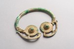
The news of the hoard made headlines all over the world and electrified its home county of Dumfries and Galloway. A pre-existing plan to convert the Kirkcudbright Town Hall into a major art gallery gained whole new steam with the prospect of the Galloway Viking Hoard as the centerpiece of the collection. The budget for the conversion was cranked way up and hefty contributions secured from the Heritage Lottery fund, the Kirkcudbright Common Good Fund and the council itself. The new Kirkcudbright Art Gallery would be a secure, state-of-the-art setting for the display of the hoard near where it was discovered.

But the course of true hoard love never did run smooth, and some David-and-Goliath museum drama has churned in the background of this campaign. The Kirkcudbright Art Gallery doesn’t actually exist yet, while National Museums Scotland (NMS) sure does. NMS wants the Galloway Hoard. The Dumfries and Galloway Council released a statement last month expressing their support for a joint bid with NMS that would give the county and the national museum joint custody of the hoard.

In order to find a way forward, our Council has conducted a detailed options appraisal. This appraisal highlighted 3 main options that our Council could take. We could apply for sole ownership of the Hoard, we could enter into a joint agreement with NMS, or we could withdraw our interest in homing the Hoard. This appraisal provided many positive and negative reasons why each option should be explored, but mainly highlighted that the Hoard needs to have some connection with Kirkcudbright and the region, and that applying for sole ownership would bring serious financial pressures with it. It was therefore decided by Members at the meeting on 24 January to pursue a joint agreement with NMS, but for adjustments to be made to the current proposal, to give Kirkcudbright Gallery and Dumfries and Galloway as a whole, a more flexible position in terms of a joint ownership of the Galloway Viking Hoard.

NMS totally ghosted them. Requests from the council that National Museums Scotland spell out the details of the partnership and clarify how much time the hoard would spend in Kirkcudbright went unanswered. With deadlines on the horizon and the ominous prospect of a deep-pocketed national museum bidding against the scrappy county underdog, the Galloway Viking Hoard Campaign has taken matters in hand.

[Campaign chair Cathy Agnew] said: “This is a time for Scotland to take the lead. The Galloway Viking Hoard is quite extraordinary and should have pride of place in a specially created exhibition space in the new Kirkcudbright Art Gallery. Remarkable finds have so often been whisked away from the communities where they were discovered only to become a small feature in a large national museum. This is a very old-fashioned approach and in 2017 we should be making sure that regions fully benefit from their cultural riches.

“Having a collection of this kind in Dumfries and Galloway would act as a powerful magnet to bring in visitors from all over the country and overseas, benefiting the local economy by encouraging them to spend time here visiting historic sites.”

The Scottish Archaeological Finds Allocation Panel (SAFAP), the body of the Treasure Trove Unit tasked with advising the Queen’s and Lord Treasurer’s Remembrancer which museum a treasure should be allocated to and how much the ex gratia payment to the finder and landowner should be, is scheduled to meet on March 23rd to determine their recommendation for the Galloway Viking Hoard. The campaign is hoping to make some substantial noise before that meeting in the hopes of boosting Dumfries and Galloway’s bid. The website is still a work a progress — there isn’t even a donation button yet — but for now the campaign is asking for people to send letters to the Dumfries and Galloway Council and SAFAP. They also have an email sign-up if you’d like to receive updates on the campaign.

This Roman road brought to you by McDonald’s

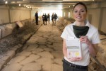
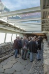
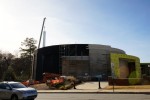
On Tuesday, February 21st, the first archaeological museum underneath a McDonald’s opened in the Frattochie ward of Marino, a town about 12 miles south of Rome. The museum was built around a pristine stretch of Roman road dating to the 2nd/1st century B.C. discovered in 2014 during construction work on a new McDonald’s. McDonald’s Italia financed the conservation of the road to the tune of 300,000 euro ($317,000). The local Archaeological Superintendency supervised its careful excavation and the installation of underground museum gallery.

The restaurant was still built over the site, but it was designed in a bridge-like shape with transparent flooring that makes the Roman road visible under your feet both when you’re waiting inside for your Royale with Cheese and when you’re sitting outside on the patio. If you prefer to eat elsewhere, what with being in Italy and all, you can still visit the underground museum. It has independent access so you don’t have to walk through MickyD’s to get to it, and entrance is free of charge, courtesy of the Clown.

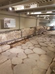
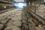
The road begins near the XI mile of the Via Appia. It’s stretch 45 meters (148 feet) long paved with slabs of siliceous rock bounded on both sides with opus incertum walls made of medium to large pieces of local volcanic rock (peperino and basalt) set in a grey mortar. The ruts of hundreds of years of wagon wheels are deeply embedded in the pavers. The average width is 2.1 meters (a hair under 7 feet). Going towards the Appia, a u-shaped drainage canal runs along the right side of the road, while on the left side the edge stones survive in excellent condition and there’s a little sidewalk .8 meters (2.6 feet) wide. There is evidence that the road was repaired repeatedly in antiquity.

The section was cut off relatively recently, on the east end by the construction and demolition of an industrial plant and by the construction of the New Appian Way on the west end. Nobody noticed the ancient road they cut through. It wasn’t a complete unknown, mind you, just forgotten. The existence of a road feature had been noted on topographical maps as early as the 18th century, but it was architect and antiquarian Luigi Canina who put it on the archaeological map. Canina in his role as Papal Commissioner of Antiquities directed the project of cleaning, restabilizing and restoring the Via Appia Antica and its many funerary monuments between 1851 and 1855. His efforts transformed fragmented, overgrown, ramshackle ruins into the usable road and open-air archaeological park it still is today. In his 1853 work documenting the first section of the Appia, La prima parte della Via Appia dalla Porta Capena a Boville, Canina identified it as a “communication route of the Appian Way at Castrimenio.”

Frattochie, next to Castrimenio, is the modern descendant of the ancient Roman town of Bovillae, the legendary place of origin of the Gens Julia. According to the founding myth of Rome, its father city Alba Longa was destroyed by Roman king Tullus Hostilius in the 7th century B.C. and all of Alba Longa’s sacred objects were moved to Bovillae. These objects and the rituals connected to them were the foundations of Rome’s religions, so Bovillae became an important (and wealthy) religious center. The offshoot of the Appia was likely built for the benefit of a wealthy noble resident of Bovillae who wanted a nice, properly paved road to take him to his doorstep.

Bovillae reached its peak when the Julians came to prominence in Roman politics. Augustus’ body lay is state there before returning to Rome, and Tiberius invested heavily in public buildings including a theater, a circus and a chapel dedicated to the Gens Julia. The town declined after the Julio-Claudians died out in the 1st century. By 326 A.D., it was so insignificant it didn’t garner a mention in a document wherein Emperor Constantine I donated land that included Bovillae to a cathedral in Albano Laziale. Whatever was left of it must have suffered greatly when Alaric I sacked Rome in 410. The towns along the Via Appia were the first to feel the Visigothic wrath.

Following the fortunes of the town, between the 2nd and 3rd centuries A.D. the road fell into disuse. It became overgrown with vegetation and covered with soil. The locals put the path to good use. Like the Via Appia, it was lined with burials and tombs. One of the tombs is still visible today on the property of the Abbey of Our Lady of the Holy Sacrament, a Trappist monastery in Frattocchie which, just fyi, makes outstanding chocolate.

The McDonald’s excavation unearthed the skeletons of three adult males buried in the 2nd-3rd century A.D. along the stretch of road. Each was in his own grave, with the three graves relatively close together towards the center of the surviving road section. Casts of the skeletons have been placed in the locations of the original graves along the road in the underground museum.

Is this the skull of the legendary “weasel bear”?

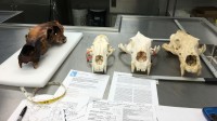
A huge polar bear skull with very different features from modern polar bear skulls has been discovered at an eroding archaeological site in northernmost Alaska. Its massive size and elongated, narrow shape recall an unusual polar bear reported by Inuit hunters but never photographed, filmed or in any other way scientifically verified.

In interview projects documenting the traditional knowledge of the Inuit peoples of northern Alaska and the western Canadian Arctic, hunters report very rare sightings of a bear “that has a longer neck; it’s high and pure white, but looks like a weasel and runs fast like a weasel”. This creature is known as “tiriarnaq” in the Siglitun dialect, “tigiaqpak” in the Kangiryuarmiut dialect, all of them translating to “weasel bear.”

Here’s a description of a weasel bear by a Sachs Harbour hunter from a 2010 interview:

“You get sometimes bears which we call tiriarnat, and they get over 11 foot. They get very big; they’re slim, their necks are way longer than the stubby bears that we get now. I never seen a weasel type bear for years, years and years…. We used to see some north of Storkerson Bay when we travel…. And they’re very big…. Stubby bears get ten [feet] three [inches], ten [feet] four [inches], that sort of thing. But a weasel type bear is 11-foot plus.

There are differences between some of the accounts of the weasel bear — some say they’re fat, not slender, others say they’re all male — but the large, long, narrow head and neck is common to all the stories. The recently discovered skull fits the description.

“It looks different from your average polar bear,” said Anne Jensen, an Utqiaġvik-based archaeologist who has been leading excavation and research programs in the region.

Through radiocarbon dating and subsequent analysis, Jensen and her colleagues estimate that the big bear skull — which appears to be the fourth largest ever found — is from a period between the years 670 and 800. It is possibly the oldest complete polar bear skull found in Alaska, inspiring a name for the departed creature that owned it: The Old One.

Exactly what accounts for its differences is yet to be determined; genetic testing is needed for that, Jensen said. It could have been a member of a subspecies or a member of a different “race” in genetic terms — similar to the varying breeds that are found among dogs — or possibly something else entirely, said Jensen, who works for the science department of the Native village corporation, Ukpeaġvik Iñupiat Corp., or UIC.

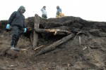
The rapid thawing of the permafrost on the Chukchi Sea coast has exposed the archaeological site of Walakpa, 13 miles southwest of Utqiaġvik (the northernmost city in the United States formerly known as Barrow). First excavated by Smithsonian anthropologist Dennis Stanford in the late 1960s when the permafrost was still perma, Walakpa is a settlement from the Birnirk period (600-1300 A.D.). It was widely believed to have been so thoroughly explored by Stanford’s team that there were no archaeological materials of note left to discover.

Climate change proved that consensus wrong in the late summer of 2013 when the face of a bluff sheered off after a storm, exposing the timbers of an ancient house. They could not be fully excavated due to adverse environmental conditions and lack of funding. In 2014, a 90-foot section of soil collapsed. A local discovered the polar bear skull at that time, although exactly where and when is unclear.

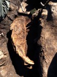
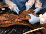
Anne Jensen was finally able to raise the funds for a solid three-week dig last summer. The exposed timbers were lost by then, but Jensen’s team unearthed a number of artifacts and remains preserved for centuries in the permafrost and recovered before their decay was accelerated by the warming soil. The sheered-off bluff where the timers were found still harbored a rare treasure: four mummified seals, naturally preserved in what had once been an ice cellar. These are the only mummified seals ever found outside of the McMurdo Dry Valleys of Antarctica. Jensen excavated one of them, a female dubbed Patou dating to the mid-1940s whose body is intact from fur to claws.

Time is running out for this site and many others in Alaska, and funding hasn’t come to close to keeping up with the pace of site deterioration.

The good condition of the artifacts is only temporary. As thaw and erosion occurs, items fall into the sea or, if exposed to the air, are at risk of decay.

Even if they are not exposed to air, artifacts can be vulnerable to below-ground degradation, Jensen said. As soils warm, bacteria are better able to decompose bones and other items. Even worse, warming soils can bring the items to a point where they generate their own heat, speeding the decomposition process.

With open water present up to eight months of the year instead of two and with temperatures rising and shorelines crumbling, the threats to the archaeological sites are increasing exponentially, Jensen said. Sites are eroding at a rate that far outpaces the normal grant process used to secure funding for work, and some new emergency approach is probably warranted, she said.

“It’s like the library is essentially on fire — now,” she said.

Navy posts Hunley recovery report online

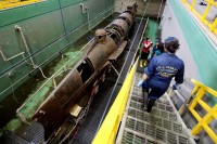
The U.S. Navy has released a comprehensive archaeological report on the recovery of the Confederate submarine H.L. Hunley and it is a total page-turner.

The Hunley sank off of Charleston Harbor on February 17th, 1864, but not before taking down its target, the USS Housatonic, in the first successful torpedoing of a ship by a submarine. Famous for this feat and for its disappearance immediately after the clash, the wreck of the Hunley was much sought by scholars, archaeologists and an adventure novelist. After decades of scholarship and fruitless searches, it was the novelist, Clive Cussler, with a team of experts from the National Underwater and Marine Agency (NUMA), who found the wreck in 1995. It was tilted on its starboard side, embedded in the seabed at a 45 degree angle and buried under feet of silt.

The idea of raising the hand-cranked iron submarine that played such a seminal role in the development of naval technology was a daunting one. It had been protected for 131 years by its silten blanket, and any excavation could endanger the sub. If it survived being dug out, then it would have to be safely raised out of the water, a logistical challenge of massive proportions. But the incentives to take the plunge were strong. Unlike other shipwrecks, Hunley almost certainly had sealed compartments that contained not just untouched artifacts, but the remains of the eight brave crewmen who operated this terrifying contraption. With the news of the discovery making headlines all over the country, the wreck would certainly become the target of looters.

Five years passed from discovery to recovery, five years of assiduous research, planning and problem-solving. You don’t have to be Civil War or naval history buff to find the Navy’s report on the recovery project riveting. It covers so much ground that anyone with an interest in archaeology, conservation, science, engineering, metallurgy, museums, even project management will be fascinated. I’ve read a lot of archaeological reports over the years, but I’ve never read one this thorough. It goes into depth on the historical background of Hunley, including its predecessors, recovery attempts after the war and searches in the 20th century. It’s not just verbiage, either. There is a plethora of pictures, maps and diagrams.

Dr. Michael McCarthy of the Western Australia Museum, who participated in a 1999 symposium of experts convened to discuss the recovery of H.L. Hunley, puts it beautifully in the foreword:

[This report] ably brings to the world the complexity of such a multi-faceted project, its own history, including the search and finding, the engineering problems and solutions, the archaeology, conservation, historical research, public access, and future exhibition plans. Clearly evident is the fact that it has all required perseverance, dedication, and exceptional time management from not only the archaeologists, researchers, and conservators, but those who managed the funding and the enormous resources required to complete the project. What editors Robert Neyland and Heather Brown have brought together and presented in what follows is a fitting and lasting tribute to the project’s many and various constituents and, like H.L. Hunley itself, it is a monument to its builder and to its three brave crews, young men once lost and now known to all.

The 321-page document can be downloaded free of charge in pdf format here.

How to move a painting the size of football field

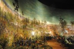
For a brief window in the 1870s and 80s, cycloramas were all the rage in the United States. The trend began with large-scale panoramas in the late 18th century. European artists pioneered the form, creating massive works that depicted famous battles, Biblical and mythological scenes, landscapes, famous explorers exploring exotic lands and more. This evolved into cycloramas, 360 degrees paintings installed in purpose-built circular buildings so that viewers on a central platform could have a full-immersion experience of being in the middle of the action.

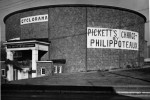
Cycloramas caught on in the 1870s after the Franco-Prussian War inspired a proliferation of battle depictions. It was European artists who brought their techniques of creating massive 360 degree paintings to the United States. The Battle of Gettysburg, now at the Gettysburg National Military Park and the largest oil painting in the world, opened the cyclorama floodgates. French artist Paul Philippoteaux, who had been painting cycloramas in Europe since 1871, was commissioned to create the massive panorama by a group of Chicago investors in 1879. It took him two years and a couple of dozen of assistants to finish the piece. It went on display in Chicago in 1883 and was a runaway success, so much so that Philippoteaux was commissioned to make another three Battle of Gettysburg cycloramas.

The Gettysburg blockbuster started a trend, and the same year it first went on display, German-born Milwaukee resident William Wehner founded the American Panorama Company. He had little difficulty investors that there would be a market in the United States for massive-scale views of scenes from the Civil War. The Battle of Atlanta, fought on July 22nd, 1864, was the chosen subject for the American Panorama Company’s second and most elaborate work, and little wonder since one of Wehner’s patrons was Illinois senator and Union Major General John “Black Jack” Logan who had commanded the Fifteenth Corps in the Battle of Atlanta.

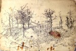
Wehner recruited a team of 20 artists from Germany, each experts in large-scale painting and specializing in certain areas — landscape, horses, human figures — and researched the battle assiduously. They had access to the sketchbooks and notebooks of Harper’s Weekly Civil War campaign artist Theodore Davis, official government documents and maps, spoke to veterans of the battle from both sides, and traveled to Atlanta so they could scope out the site of the battle with their own eyes. Even though the neighborhood where the battle took place (Edgewood, then an eastern suburb, now intown Atlanta) was completely unrecognizable just 20 years later, the artists were able to view tracks and landscape features by sketching from towers.

The Battle of Atlanta made its debut in February 1887 in Detroit. Senator Logan had died in December of 1886 and the work was advertised as “Logan’s Great Battle” in homage to him. His cavalry charge to reinforce the Union lines was a featured scene in the cyclorama. Believe it or not, this massive painting more than 370 feet wide and just shy of 50 feet high was designed to be moved. After it was shown in Detroit, vast swaths of the canvas were draped on wooden frames and taken on the road where it was shown in Minneapolis and Indianapolis. The Cyclorama opened in Indianapolis in May of 1888 and by then Wehner’s company was in trouble. He sold The Battle of Atlanta to a local exhibitor. In 1890, that company sold it to promoter Paul Atkinson of Madison, Georgia.

Atkinson put it on display in Chattanooga, taking it south of the Mason-Dixon line for the first time. It finally set foot in Atlanta in February 1892, where Atkinson put it on display in a wooden building on Edgewood Avenue, close to the battle site. In Atlanta, Atkinson promoted the one-time “Logan’s Great Battle” as the only painting of a Confederate victory, and he had it altered to make sure it fit the new pro-Southern narrative. A group of cowering Confederate prisoners were changed to retreating Union soldiers, for example.

(It’s true that the Battle of Atlanta ended with the Union’s failure to take the city and the death of Major General James McPherson, one of the highest-ranking Union soldiers to fall in battle during the Civil War. General Sherman had to besiege Atlanta for more than a month before the city finally surrendered on September 2nd, 1864. Still, the one-day Battle of Atlanta was something of a Pyrrhic victory given the 5,500 Confederate casualties they could ill-afford this late in the war, and since the final conclusion of the wider fight for Atlanta was a decisive Union victory that played an important role in revitalizing Northern enthusiasm for the war and in re-electing President Lincoln, Atkinson’s pitch was more than a little disingenuous.)

The days of the great panoramas in the round drawing crowds were over by then, however, and the Edgewood Avenue exhibition was financial failure. A year later, the painting was sold for a comparative pittance to Atlanta business magnate Ernest Woodruff. He quickly resold it to George V. Gress and Charles Northen. They had it repaired and installed in a new building in Grant Park, but again The Battle of Atlanta failed to attract visitors. In 1898, George Cress donated the painting to the City of Atlanta.

The city created a new building to house it in Grant Park in 1921. For some unfathomable reason, instead of just measuring the thing and making proper calculations, the new building which, once more for emphasis, was custom-built to house the painting, could not fit the whole painting. About eight feet of sky and a vertical section six feet wide were sliced out to squeeze it into the new Atlanta Cyclorama building.

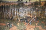
In 1936, a Works Project Administration team completed a diorama covering the space between the bottom of the painting and the edge of the viewing platform. On a red clay floor evoking Georgia’s characteristic russet heavy soil, landscape features, artillery, railroad tracks and 128 plaster soldiers were added to bring the painted scene into three dimensions. The soldiers ranged in size from 20 to 50 inches high and were placed to ensure they’d be in proper perspective and scale with the painting when viewed from the platform.

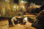
Condition issues proliferated over the decades at Grant Park. Twenty years of discussions from the late 1950s until the late 1970s considered a number of solutions to the problems, all of them rejected as too expensive. Finally between 1979 and 1982 the painted and diorama were conserved and the building renovated to include a revolving viewing platform.

Since then, the painting continues to struggle with condition issues. Meanwhile, Zoo Atlanta, which shares space in Grant Park with the Atlanta Cyclorama and draws far, far larger crowds than the painting could ever dream of drawing, is keen to expand. In 2014, Atlanta Mayor Kasim Reed announced that the cyclorama would be moved to a new state-of-the-art facility at the Atlanta History Center‘s 33-acre campus in the toney Buckhead neighborhood.

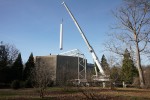
Moving a painting 359 feet wide and 42 feet high that weighs seven tons is not for the faint of heart. It has taken more than two years to plan and prepare the move. Earlier this month, the deed was done, in a painstaking series of steps.

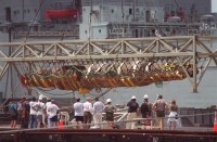
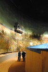
Workers, Mr. McQuigg replied, will spend days rolling the painting, which is appraised at $7.5 million, onto a pair of 6,200-pound spools. A crane will slowly lift the spools — “We’re hoping paint-drying goes faster,” Mr. McQuigg said in an interview — through seven-foot holes cut in the roof of the nearly century-old building. Then, once the shrink-wrapped painting is resting aboard two trucks, the workers will let the clock tick.

“We’re going to wait until everybody goes home and the traffic dies down and there’s no more Atlanta rush hour,” Mr. McQuigg said in the musty room where the cyclorama has hung for generations. “Heck, it might be 3 in the morning.”

That’s pretty much what happened, although the two giant spools were raised on different days. The first scroll did end up being transported in the middle of the night to the new Lloyd and Mary Ann Whitaker Cyclorama Building at the Atlanta History Center. The second was moved during the day.

Now that they’re in the new building, the sections of the painting will be reunited and restored.

The restored painting will finally have the proper perspective: Until now, the painting hung like a shower curtain and there were folds and creases. When the painting reopens next year, the aim is to return the “immersion” effect.

The Battle of Atlanta will be displayed in its original hyperbolic, or hourglass shape. Through proper tension at the top and bottom, the painting’s horizon will appear closer to the viewer, restoring the original 3D illusion.

You’ll be able to see the whole painting: At Grant Park, patrons sat on a carpeted revolving grandstand, which kept them from taking in the entire painting at once. At the AHC, visitors will gaze from a platform 15 feet above ground. The diorama will be rebuilt. The idea is to remove as many obstructions as possible and let the painting make its own statement.

The Battle of Gettysburg is the same height as the Atlanta Cyclorama, but it’s 377 feet wide. When the restoration is complete, The Battle of Atlanta will get a little closer in width and beat it in height. The pieces cut out to squeeze Procrustes the Painting into the 1921 Atlanta Cyclorama building will be readded so that for the first time in almost a century, the complete panorama will be seen as the German painters created it. The restored cyclorama will be 371 feet wide and 49 feet high. The Atlanta Cyclorama will reopen to the public in the fall of 2018.

Here are timelapse videos of the two halves of the painting being scrolled up. The first half was scrolled on December 7th, 2016, the second on January 21st, 2017.

Here is the first scroll raised from a hole in the roof of the old Atlanta Cyclorama building and then being laid on the flatbed truck for transport to the new building.

This news story has film of the cranes lowering the massive scrolls into the new cyclorama building at the Atlanta History Center:

[youtube=https://youtu.be/pHJMvVom3Go&w=430]