Tomb of Caecilia Metella reveals secrets of Roman concrete resilience

The tomb of Caecilia Metella, the turret-shaped funerary monument on the Via Appia Antica outside the ancient walls of Rome, was built out of concrete, brick and travertine between 30 and 10 B.C., a time when Roman architecture saw major advances in concrete construction. The circular concrete tomb was faced with blocks of travertine and built on a square foundation of concrete with volcanic stone aggregrate. Inside is a conical burial chamber with an oculus opening in the ceiling. The sepulchral corridor was constructed of brick-faced concrete that is one of the first examples in Rome, built to the highest possible standards of the time.

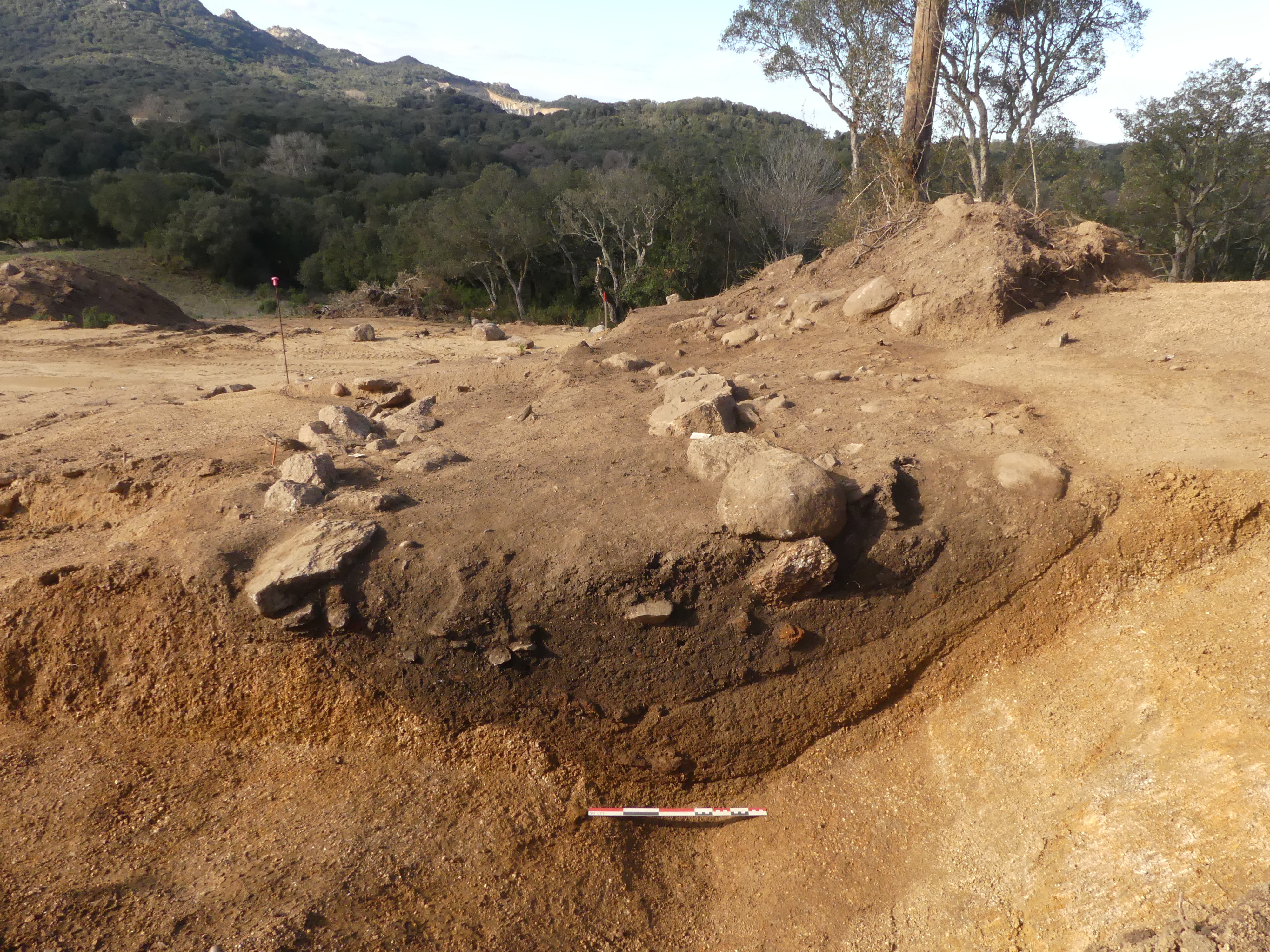
The tomb is located on the northern tip of the Capo di Bove lava flow; its lower chamber was dug through the tephra deposited hundreds and thousands of years ago in the eruption of the Alban Hills volcano. The same volcano also deposited tephra in a lava flow, the Pozzolane Rosse, less than a half mile away northwest of the tomb.

The builders of the Tomb of Caecilia Metella sourced their aggregate from both fields, using the Capo di Bove lava for the outer structure’s concrete, brick mortar and interior concrete. The sepulchral corridor (the wettest part of the tomb, exposed to rainwater falling through the oculus as well as ground water penetration) used the tephra from the Pozzolane Rosse flow, the same aggregate employed in the construction of the walls of the Markets of Trajan 120 years later. They too are still standing.

Roman concrete construction like this tomb, bridge piers and breakwaters has shown itself uniquely capable of withstanding thousands of years of water exposure, even submersion, whereas modern concrete, made with cement binders that Roman concrete does not have, cracks and crumbles comparatively speedily under pressure from water. Modern marine concrete has an expected lifespan of just 50 years.

A new study looks at mortar samples taken from the sepulchral corridor of the Tomb of Caecilia Metella to learn more about the mineral structure of the concrete hoping to shed light on its extraordinary longevity.

In previous analysis of the Markets of Trajan mortar, Jackson, Tamura and their colleagues explored the “glue” of the mortar, a building block called the C-A-S-H binding phase (calcium-aluminum-silicate-hydrate), along with a mineral called strätlingite. The strätlingite crystals block the propagation of microcracks in the mortar, preventing them from linking together and fracturing the concrete structure.

But the tephra the Romans used for the Caecilia Metella mortar was more abundant in potassium-rich leucite. Centuries of rainwater and groundwater percolating through the tomb’s walls dissolved the leucite and released the potassium into the mortar. In modern concrete, such a flood of potassium would create expansive gels that would cause microcracking and eventual spalling and deterioration of the structure.

In the tomb, however, the potassium dissolved and reconfigured the C-A-S-H binding phase. Seymour says that X-ray microdiffraction and Raman spectroscopy techniques allowed them to explore how the mortar had changed. “We saw C-A-S-H domains that were intact after 2,050 years and some that were splitting, wispy or otherwise different in morphology,” she says. X-ray microdiffraction, in particular, allowed an analysis of the wispy domains down to their atomic structure. “We see that the wispy domains are taking on a nano-crystalline nature,” she says.

The remodeled domains “evidently create robust components of cohesion in the concrete,” says Jackson. In these structures, unlike in the Markets of Trajan, there’s much less strätlingite formed. […]

Admir Masic, associate professor of civil and environmental engineering at MIT, says that the interface between the aggregates and the mortar of any concrete is fundamental to the structure’s durability. In modern concrete, he says, the alkali-silica reactions that form expansive gels may compromise the interfaces of even the most hardened concrete.

“It turns out that the interfacial zones in the ancient Roman concrete of the tomb of Caecilia Metella are constantly evolving through long-term remodeling,” he says. “These remodeling processes reinforce interfacial zones and potentially contribute to improved mechanical performance and resistance to failure of the ancient material.”

The study is part a U.S. Department of Energy  ARPA-e project that hopes to use ancient Roman know-how to create more durable and energy-efficient concrete. It has been published in the Journal of the American Ceramic Society and can be read in its entirety here.

3D model reveals Easter Island writing

A 3D model of a wooden tablet from Easter Island has revealed engravings in the rongorongo writing system invisible to the naked eye. A new study of a tablet now in the collection of the Berlin Ethnographic Museum, employed photogrammetry to create a high-precision digital reconstruction of the wood surface

Researchers estimated that there are about 600 characters of rongorongo. Among them there are representations resembling human figures, characterized by supernaturally long arms, shown in various arrangements, as well as animals: birds, fish, sharks and rats. No other Polynesian peoples invented the script. Scientists are now making efforts to read the mysterious writing. Despite many question marks, researchers of the mysterious writing have established a few facts. First of all, it is known that it was used by the aristocracy living on the island – so it was not a commonly used script. Sentences were read in the inverted boustrophedon system – the object had to be rotated while reading.

Because the island of Rapa Nui is so remote its culture developed in total isolation from the Polynesian settlement in the 12th or 13th century until the arrival of Dutch explorer Jacob Roggeveen in 1722. The first westerner to encountered rongorongo was French missionary Eugène Eyraud who saw the symbols in islanders’ homes on his first mission to Rapa Nui in 1864. By then the system had rapidly fallen into disuse, believed to be a result of its writing elite being captured and enslaved in the Peruvian raids of the early 1860s. In a December 1864 letter to the Father Superior of his order in Paris, Eyraud wrote:

In all the homes there were wooden tablets covered with many types of hieroglyphic characters, which are symbols of animals that do not exist on the island and which the natives incise with a sharp stone. Each symbol has a name but the minimal fuss that the natives make of these tablets leads me to believe that these symbols, the remains of a primitive writing system, represent a custom that they continue to practice without trying to recall its meaning.

A piece of an engraved tablet was gifted to Bishop Tepano Jaussen of Tahiti in 1869, and he encouraged the collection of all other tablets with inscriptions still surviving on Rapa Nui. Ravaged by slave raids, deforestation, the invasive Polynesian rat and massive emigration, the population of the island collapsed in the 1870s.

Today only 23 rongorongo-engraved artifacts are known to exist, none of them on Rapa Nui. Rongorongo’s origins are unknown and the glyphs are as yet undeciphered, but if it is confirmed to be a writing system, it will be one of very few examples of an independently invented script in human history.

The Berlin Tablet was made from a large curved tree branch with the sides carved out to form flattened surfaces for incision. It is 3’4″ long and weighs 5.7 lbs, making it the heaviest rongorongo artifact surviving. It was one of three belonging to Chief Hangeto that were sold to Germany in 1882. It is in a poor state of preservation, heavily damaged on one side that is believed to have been facing the soil of a cave floor for years before it was collected. Woodlice, centipedes and woodworms also made a tasty meal of it.

The new study took tiny samples from the damaged side of the tablet for botanical identification and radiocarbon dating. The wood was identified as T. hespesia populnea, the Pacific rosewood which was one of the only naturally occurring tree species on Easter Island. Radiocarbon dating found that it was made between 1830 and 1870.

“On the other side of the tablet and on its edges, we managed to see invisible to the naked eye symbols that have so far eluded researchers, as well as grooves – similar ones are present on some other rongorongo tablets. They served as lines delimiting the text and were to facilitate writing”- specified [Dr Rafał Wieczorek]. On this basis, the researchers were able to estimate the size of the entire text on the plate at approx. symbols.

“If the tablet had been preserved in its entirety, it would have been the longest Rongorongo script in the world. Currently, most signs are on the so-called the staff of Santiago. There are about 2.3 thousand of them there.” the scientist pointed out. The Berlin plate – according to the Polish researcher – probably contains a list of names and a descriptive part.

Only 387 glyphs are legible half of one side of the tablet today, but researchers estimated based on the geometry of the tablet that it originally covered with over 5000 signs, which is more than double the number of the next longest rongorongo inscription.

The new study has been published in the Journal of Island and Coastal Archeology and can be read in its entirety here.

Unique Scythian glass pendants found in Ukrain

Archaeologists have unearthed unique glass pendants near the town of Kotelva in the Poltavska oblast of central Ukraine. A team from the Institute of Archeology of the National Academy of Sciences of Ukraine were excavating a Scythian-era burial ground on Barvinkova Mountain when they discovered the three small pendants that date to around the 4th century B.C. Nothing like them has been found before in Ukraine.

There is almost no information about them yet, but they are so unusual and charming I’m posting them anyway. Archaeologists are calling them amphora-shaped, but they look more like provolones to me.

Scythian-era glass pendants, ca. 4th century B.C. Photo by Oksana Doroshenko. Scythian-era glass pendants, ca. 4th century B.C. Photo by Oksana Doroshenko. Scythian-era glass pendants, ca. 4th century B.C. Photo by Oksana Doroshenko. Scythian-era glass pendants, ca. 4th century B.C. Photo by Oksana Doroshenko.

After a thorough study at the National Academy of Sciences of Ukraine, they will go on display in the museum of the Bilsk Historical and Cultural Reserve, site of the largest early Iron Age fortified settlement in Europe.

Pair of oldest ski found in Norway ice patch

The second of a 1300-year-old pair of skis has been discovered in the Mount Digervarden ice patch in southern Norway. Together they form the best-preserved pair of ancient skis in the world, and the only ones with surviving bindings that provide essential information on how the skis were worn.

A team of glacier archaeologists discovered the first of the pair in the Digervarden ice patch in 2014. Complete with surviving birch bindings, it was an exceptional find, one of only two pre-Viking skis ever found with bindings. The team has kept an eye on the site ever since, monitoring the melting ice via satellite in case the receding ice might reveal the ski’s match.

This year they saw the ice had retreated significantly, so three weeks ago a team did a field check and discovered a second ski trapped in the ice 16 feet away from where the first ski was found. It was too firmly embedded in the ice to be removed on the spot, so a large, well-equipped team returned six days later to liberate the historic ski. After shoveling away snow and chipping through the thick ice with an axe, team members were able to uncover the entire ski. A little lukewarm water loosened it all the way and the ski was retrieved.

It was found upside down in the ice. When archaeologists turned it face-up, they saw that it too had surviving binding, and it was the exact same type of binding on the ski found in 2014. This was confirmation that they were a matched set.

They are not identical, however. The newly-found ski is in far better condition because it was 15 feet deeper down in the ice than the previous find. At 6’2″ long and seven inches wide, it is seven inches longer and .8 inches wider than the first ski. This is likely due to the 2014 ski having shrunk and warped from being more exposed than its partner.

There are other differences as well, which is to be expected with handmade objects that experienced all kinds of wear and tear in the mountains of Iron Age Finland.

Three twisted birch bindings, a leather strap and a wooden plug go through the hole in the foothold of the new ski. The ski found in 2014 only had one twisted birch binding and a leather strap through the hole. Both skis have a hole through the tip. There are subtle differences in the carvings at the front of the skis. The back end of the new ski is pointed, while the back end of 2014 ski is straight.

The foothold of the new ski shows repairs, so it was well used. A part of the back end of the ski is missing. The missing piece is presumably still inside the ice. Whether it broke when lost or while inside the ice may be possible to say at a later stage based on a careful study of the edge of the break.

Part of the leather strap of the heel binding of the new ski had come off but it lay on the ground close by. Both skis are missing the upper part of the toe binding of twisted birch. We found pieces of twisted birch close to the new ski and this may belong to the binding. We cannot to say for sure if the binding of twisted birch broke before the skis were left behind, or whether the ice caused it.

This video captures the excavation and recovery of the ski:

Bronze Age village found in Corsica

The well-preserved remains of a Bronze Age settlement have been discovered in Sartène, Corsica. The site, located on a hillside overlooking the Rizzanesi river, was excavated in late 2019, early 2020 in advance of housing construction. State archaeologists unearthed the material remains of three dwellings that were part of a fortified village from the early Bronze Age (ca. 2000 B.C.).

Triangular ditch with remains of double stone wall. Photo © P. Druelle, Inrap.On the southern slope of the hill, the most exposed to an attack, archaeologists found evidence of three phases of defensive fortifications. In the first phase, wooden palisades were erected in several rows. In phase two, the village dismantled the palisades and dug a triangular ditch. Behind the ditch, an earthwork rampart was built and a single palisade erected at its peak. The ditch from this system was filled in around 1500 B.C. and a double dry stone wall filled with smaller stones was built on top of it.

Archaeologists estimate the village covered more than a hectare (2.4 acres) in area and contained an estimated dozen dwellings. The remains of the dwellings that have been excavated thus far include heretofore unknown details about life in Bronze Age Corsica.

The discovery of the roof rafter installation trenches as well as the discovery of the sand pits allow us to observe the structuring of the internal space of the houses. Divided into three rooms and bounded by a dry stone masonry base, these extend over an area of ​​approximately 50 m². The study also shows that some houses were built entirely of wood.

In addition, the archaeologists observed that the subsistence economy of the village was based on the cultivation of cereals in the surroundings, on the picking of acorns and on livestock. The meats were then smoked to be stored for several months. Silos and silage jars (buried in the earth) were used to store these commodities. Finally, craftsmanship is materialized by a discreet metallurgy and by the presence of stone ornaments and dishes.