The New York Public Library, in addition to having a glorious Beaux Arts main building, has a vast collection of historic images. More than 800,000 images are available for perusal in its Digital Collections, an invaluable resource on the history of New York. I would have made much use of it in this blog but high resolution images are only available for a fee of at least $50 apiece which is rather pricey for works out of copyright.
 This has bummed me out for years, so when I read that the NYPL was releasing more than 20,000 digitized maps, I assumed that we’d only be to view these cartographical works in versions too small to appreciate the details, which is bad enough with pictures of people or buildings but is infinitely worse with maps. Something something ass u me, because the entire collection can be viewed in exquisitely high resolution on the website and can even be downloaded! All you have to do is create an account free of charge on the NYPL’s Map Warper site and once that’s done, you see an Export tab on each map entry from which you can download the high resolution file.
Fair warning: the Map Warper takes ages to load, or at least it has for me at various times over several days. Everything I’ve accessed has eventually loaded without errors, but it took minutes. I suggest opening it in a new tab to wait out the load time. Once you have your account, be prepared to wait again for the maps to load. From the comments on the NYPL’s blog entry announcing the release, it appears to be your basic birthing pains and they have top men on it. Top. Men.
In any case, gems like these are worth the wait.
We’ve been scanning maps for about 15 years, both as part of the NYPL’s general work but mostly through grant funded projects like the 2001 National Endowment for the Humanities (NEH) funded American Shores: Maps of the MidAtlantic to 1850, the 2004 Institute of Museum and Library Services (IMLS) funded Building a Globally Distributed Historical Sheet Map Set and the 2010 NEH funded New York City Historical GIS.
Through these projects, we’ve built up a great collection of: 1,100 maps of the Mid-Atlantic United States and cities from the 16th to 19th centuries, mostly drawn from the Lawrence H. Slaughter Collection; a detailed collection of more than 700 topographic maps of the Austro-Hungarian empire created between 1877 and 1914; a collection of 2,800 maps from state, county and city atlases (mostly New York and New Jersey); a huge collection of more than 10,300 maps from property, zoning, topographic, but mostly fire insurance atlases of New York City dating from 1852 to 1922; and an incredibly diverse collection of more than 1,000 maps of New York City, its boroughs and neighborhoods, dating from 1660 to 1922, which detail transportation, vice, real estate development, urban renewal, industrial development and pollution, political geography among many, many other things.
One of the neatest features the Map Warper offers is the ability for members to rectify a map, meaning overlay it as accurately as possible over a modern digital Google Map using control points on both maps. Here’s a handy tutorial on how to rectify:
[youtube=http://youtu.be/cCbBpKZh0To&w=430]
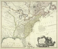
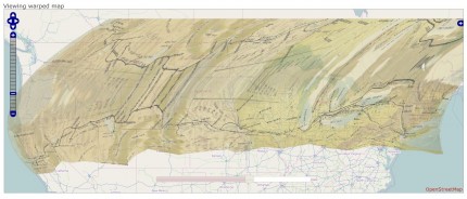
And here’s a before and after of a particularly warp-heavy map from sea to shining sea:


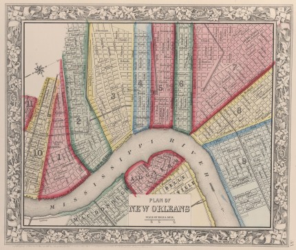
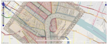
I love this one of New Orleans because the 1860 map is basically identical to the modern map only of course the city boundaries have sprawled much further afield now:


Ooooh, maps. Goodie. What a treasure for history/geography/geology/map freaks like me. And the more I get into genealogy, the more I realize how huge a role maps play in understanding how people and events fit together. They are critical. I am about to have a lot of fun, I can tell. And Livius? I really like the way you find those nearly hidden little reveals and quietly point them out. Top. Men. Indeed.
Thank you.
I had to restrain myself from making this post nothing but a bunch of before and after maps. It’s so fascinating to see history and modernity superimposed over each other.
Thank you for sharing my enthusiasm!
This is great, thanks!
I work at the U.S. Geological Survey Library in Denver, and we’re always looking for historical map resources to suggest to our patrons. (People assume that we should have vast collections of ancient maps, but in truth, most of ours are either topographic or geologic maps, and very few are older than the establishment of the USGS in 1879.)
So much for sleeping this weekend.
Thank you! Invaluable for genealogical research.