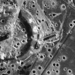
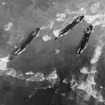
Millions photographs taken by Allied airmen during secret missions in World War II are being declassified and digitized in a huge archive called Tara (The Aerial Reconnaissance Archives).
 Tara is in Edinburgh, Scotland, now as part of the larger National Collection of Aerial Photography. Researchers have already cataloged and digitized 4000 of the pictures, but it will be years before the full 10 million photograph collection is online.
”The skill of the photo reconnaissance pilot was incredible – they were among the best pilots in the air force,” said Allan Williams, manager of the National Collection of Aerial Photography based in Edinburgh.
”As so many of them lost their lives the archive has become a memorial to them and the events on the ground they photographed. How they could take the photos they did is astonishing.
”When you remember they were taken in combat, and often being shot at – it’s astounding.”
It really is. The pictures are incredibly high quality, detailed images. You’d never guess they were taken under abysmal conditions from an airplane dodging enemy fire. They include photographs of now legendary sites, like Omaha beach in Normandy and the bridge over the River Kwai.
The archive includes pictures taken by the Royal Air Force all the way through to the 1990s and even some taken by the Luftwaffe. The bulk of the collection, however, are World War II reconnaissance.
 During the war, these pictures were used by analysts to create a 3D rendering of any given area. The compiled data were then used to plan major operations like the D-Day invasion of Normandy.
The photographs are not only of interest to the WWII buffs among us (or the photography buffs, for that matter), but they’ll be an invaluable resource for countries like Germany and Italy where unexploded ordnance is still a concern for building projects. The pictures show exactly where bombs fell but didn’t explode.
You can browse the uploaded images at http://aerial.rcahms.gov.uk/.
Photos courtesy RCAHMS/PA Wire.