Site of Salem witch trial hangings confirmed

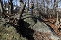
Researchers have confirmed the site in Salem, Massachusetts, where 19 accused witches were executed by hanging between June and September of 1692. It’s called Proctor’s Ledge, a rocky, wooded area between Proctor and Pope Streets at the foot of Gallows Hill. As the name suggests, Gallows Hill was generally thought to be the place where the 19 victims were hanged, but it’s a big hill and the precise location has been subject of debate and study for many years.

While almost 1,000 documents pertaining to the trials have survived, making it one of the most thoroughly documented events in early American history, there are virtually no eyewitness reports of the actual hangings. The Proctor’s Ledge spot was first suggested as the hanging site by local historian Sidney Perley in a 1921 essay. Based on his research, in 1936 the city of Salem purchased a chunk of Proctor’s Ledge “to be held forever as a public park” dubbed “Witch Memorial Land,” but the park was never made and instead of being memorialized the hanging site fell down the memory hole.
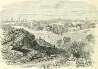
In 2010, the Gallows Hill Project was founded to re-investigate Perley’s research, examine other period documents and use new technology to pinpoint the site of the hangings.

Marilynne Roach discovered a few key lines of eyewitness testimony in a Salem witch trials court record…. The record in question is the examination of Rebecca Eames and Mary Lacey, dated August 19, 1692, the same day that five executions were carried out at the Gallows Hill site. The record quotes the defendant Rebecca Eames, who had been on her way to the court in the custody of her guards and traveled along the Boston Road, which ran just below the execution site.

A few hours later, she appeared the Salem court for her preliminary examination. The magistrate asked Eames whether she had witnessed the execution that took place earlier that morning as she was passing by. She explained that she was at “the house below the hill” and that she saw some “folks” at the execution. Roach determined that the “house below the hill” was most likely the McCarter House, or one of its neighbors on Boston Street. The McCarter house was still standing in 1890 at 19 Boston Street.

Professor Benjamin Ray conducted research that pinpointed the McCarter house’s location and worked with geographic information system specialist Chris Gist of the University of Virginia’s Scholars Lab to determine whether, in fact, it was possible for a person standing at the site of the house on the Boston Street to see the top of Proctor’s Ledge, given the rising topography of the northeastern slope of the hill. Gist produced a view-shed analysis, which determined that the top of Proctor’s Ledge was clearly visible from the Boston Street house, as well as from neighboring homes.

Geo-archaeological remote sensing on the site found that the ledge is almost entirely rock, with no more than three feet of soil in a few cracks. That means that the victims were not buried there, although they were buried somewhere nearby since as witches they were excommunicated and denied Christian burial in churchyards. There is also no evidence that there was an actual gallows erected on the site. The condemned were likely hanged from ropes slung over large tree limbs.

The city plans to go ahead with the memorial plan now, although it will have to be a modest marker since the spot is in the middle of a residential area with no clear public access or place for parking.
Excavation of mysterious Honduran site begins

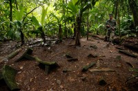
Archaeologists have begun to excavate an ancient site that may be the kernel of truth inside the legends of the lost White City in the tropical rainforest of the Misquitia region on the eastern Mosquito Coast of Honduras. The local Pech and Payas peoples have an oral tradition transmitted through the generations of a forbidden city with large buildings built from local white limestone. Spanish Bishop Cristobal de Pedraza wrote about the tale of the lost in a letter King Charles V of Spain in 1544. He said he’d seen a large city in a river valley while traveling through the jungle. His guides told him the nobles there ate on plates made of pure gold. For hundreds of years explorer searched for it, some even claimed to have found it, reporting fantastical finds of gold idols and carved white stones.

Over time the mysterious city became known as the White City after those stones. It was also dubbed “The Lost City of the Monkey God” by explorer Theodore Morde who announced to great fanfare in 1940 that he had discovered the city where ancient Mesoamericans worshiped a giant ape idol. He didn’t reveal where he’d found it to keep it safe from looters. He planned to return the next year, but he never did and he never revealed the location.

In 2012 an aerial lidar survey over the jungle spotted the remains of three urban centers that scientists unromantically dubbed T1, T2 and T3. In February of 2015 archaeologists did a preliminary exploration of T1 and counted an extraordinary 51 artifacts partially buried but still visible on the surface on the jungle floor. The President of Honduras, Juan Orlando Hernández, quickly moved to protect the site from looters, deploying armed troops to guard it.

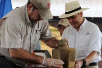
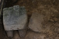
Archaeologists from the Honduran Institute of Anthropology and History (IHAH), Colorado State University and National Geographic recently returned to T1 and have already unearthed more than 60 objects, including ceramic vessels decorated with figures of jaguars, lizards, macaws and vultures. The most glamorous find so far is a stone chair or throne carved with the figure of a jaguar. Colorado State University researcher Chris Fisher believes one of the vessels with the head of a bird dates to between 1,000 and 1,500 A.D.

They have also found evidence of a pyramid and adobe structures that suggest the site was used for religious ceremonies. According to IHAH director Virgilio Paredes, the site does not appear to be Maya, the dominant culture in the region, nor is it Aztec or any other known culture.

President Hernández was present at the site on Tuesday, January 12th, to announce the finds. He has dubbed the three urban centers collectively “Kaha Kamasa” which means White City in the Misquito language, and T1 “Jaguar City” after the jaguar artifacts. T1 is the smallest of the three cities and archaeologists have barely scratched the surface. They believe the sites together could be four times larger than Mayan site of Copan, a major regional capital in western Honduras.

MH370 search discovers 200-year-old shipwreck

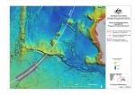
The Australian government is conducting an ongoing search operation for missing Malaysia Airlines Flight MH370 which disappeared on March 8th, 2014, on its way from Kuala Lumpur to Beijing. There were 239 people on board. The Malaysian government asked Australia for help searching the southern Indian Ocean which satellite communications indicate is where the airplane was flying before its disappearance. The Australian Transport Safety Bureau (ATSB)has been scanning the seabed about 100 miles southwest of Perth since October of 2014.

There is as yet no trace of the aircraft, but on December 19th, 2015, one of the ships spotted an anomaly on the sonar. Analysis of the image suggested it was a man-made object, probably a shipwreck, but to be sure the search ship Havila Harmony sent down an Autonomous Underwater Vehicle (AUV) to examine the anomaly. This area of the ocean floor is so mountainous it’s difficult to search with the deep tow sonar; the AUV can get detailed information on what’s down there without having to be tied to the ship.

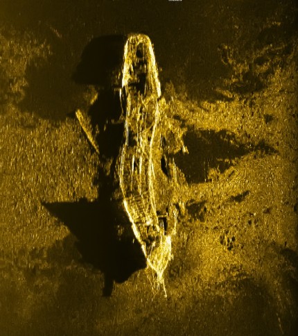
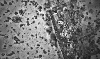
On January 2nd, 2016, the AUV captured a high-resolution sonar image of the object which confirmed that it is indeed a shipwreck at a depth of 2.3 miles. The sonar imagery was sent to experts at the Shipwreck Galleries of the Western Australian Museum. Their preliminary conclusion is that the wreck is of steel or iron-hulled ship from the early 1800s.

Considering it sank 200 years ago landing on a rugged ocean floor, it looks to be in remarkable condition. It’s still shaped like a ship, only with a large curve in the middle it didn’t have when it was sailing the seas, and I see little scattered debris in this image. Early iron ships often had significant wood parts like planked weather decks, so there would have been plenty of material to scatter.

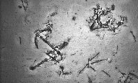
Compare it to the remains of ship discovered during the search in March of 2015. They were discovered at a depth of 2.5 miles, so the ship had a little longer to fall, but all that’s left of it is an anchor, some black balls that are probably lumps of coal and some unidentified man-made objects including a rectangle about 20 feet long.

Round houses found at Bronze Age Must Farm site

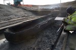
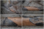
The Must Farm Quarry in the Cambridgeshire fens near Peterborough, southeast England, is the site of the largest collection of Bronze Age artifacts ever discovered in Britain. It was first found in 1999 by a local archaeologist who saw the tops of timber posts bristling at the edge of the working quarry. Small archaeological investigations followed in 2004 and 2006, with the latter unearthing pottery of exceptional quantity and variety, plant fiber textiles, woven willow baskets used as fish weirs, glass beads, tools, weapons, even a bowl of food — later found to be nettle soup — with a spoon still standing inside it. A 2011 excavation discovered an unheard of eight perfectly intact log boats.

The reason so many organic remains survived for more than 3,000 years at Must Farm is that soggiest of archaeological jackpots: waterlogged soil. When the settlement was built on the ancient Nene River channel in about 1,300 B.C., the land that would become the Flag Fen basin was still mostly dry with the river as the major thoroughfare. Water levels started to rise, flooding the low-lying areas and forcing the inhabitants to adapt their architecture and lifestyles accordingly. Things lost to the rising waters were embraced by the mud and covered by deposits of silt and clay that protected them from oxygen and microorganisms that cause organic materials to decay.

In the early stages of settlement, large square cut oak piles were driven into the river channel to support a wooden platform. Part of the structure collapsed, pinning a fish weir beneath it for our edification. Water flooded the structure. Between 1,000 and 800 B.C., new piles were sunk and a wooden palisade was added around the platform to impede the flow of water. Sometime between 920 and 800 B.C., the site was struck again, this time not by water but fire. The structure burned and dropped into the river. The water doused the flames; the charred organic material sank to the bottom of the stream. The combination of fire carbonizing organic remains, water stopping the fire before it consumed all and mud encasing everything was a perfect storm to preserve an entire Bronze Age household for 3,000 years.

Last September, a new excavation funded by Historic England and Forterra, the company that owns the clay quarry, set out to explore the timber platform. The Cambridge University Archaeological Unit has been digging for three months. They have five more months to go and they’ve already made extraordinary finds, most significantly evidence of collapsed round houses on stilts, at least five of them. They are the best preserved Bronze Age homes ever discovered in Britain by far. Usually all archaeologists have to go on is postholes.

[Site director Mark] Knight said possible reasons for the fire included a cooking accident, deliberate destruction and abandonment of the site, or even enemy attack. But whatever happened, the people abandoned their possessions and left precipitously: “This is a world full of swords and spears – it is not entirely a friendly place.

“We’re used to finding a bit of pottery and trying to reconstruct a civilisation from that,” he said. “Here we’ve got the lot. We should be able to find out what they wore, what they ate and how they cooked it, the table they ate off and the chairs they sat on.

“These people were rich, they wanted for absolutely nothing. The site is so rich in material goods we have to look now at other bronze age sites where very little was found, and ask if they were once equally rich but have been stripped.”

This wealth is confirmed by animal remains which are overwhelmingly land animals like sheep, pigs and cows rather than the plentiful fish, eels and mussels the inhabitants were living on top of. The articulated spine of a cow was found in one of the houses, likely a carcass that was being butchered before the fire stopped time. At this point the water levels in the settlement and environs were high, so the livestock can only have been pastured on land a third of a mile away.

Archaeologists also found the first human remains a few weeks ago. So far only a skull has been excavated; archaeologists don’t know if there’s a skeleton yet to be dug up — one of the residents of the home caught in the fire, perhaps — or if the skull was a standalone item like a war trophy or amulet or devotional object.

The timber platform excavation has gotten a lot of press in the past few days, very deservedly so, but the news stories are cursory at best and they also weirdly treat the Must Farm settlement as if it’s an entirely new discovery instead of the latest phase of years of excavations. If you crave detail and accuracy, you can follow the progress of the dig on the Must Farm’s exceptional site diary and Facebook page of wonders. The team does a phenomenal job of keeping the public updated, explaining the finds, their archaeological significance, the excavation process and sharing great photographs.

Infernal Landscape drawn by Hieronymus Bosch

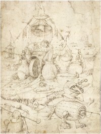
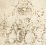
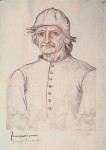
A drawing previously thought to have been made by an assistant in the workshop of medieval Dutch artist Hieronymus Bosch has been authenticated as a piece by the master himself. Infernal Landscape is a little-known drawing first emerged in 2003 when the anonymous owner sold it auction to an equally anonymous buyer. It has been squirreled away in a private collection since the sale. The Bosch Research and Conservation Project (BRCP), an international art history study that has been researching, analyzing and documenting the oeuvre of the medieval master since 2010 in anticipation of the 500th anniversary of Bosch’s death this year, were able to examine the drawing before its first public exhibition this year in honor of the anniversary.

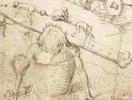
The drawing shows a chaotic, scary, monstrous hell where the souls of the damned are caught in a large fishing net rigged up to a water wheel in the maw of a hellbeast. Some are condemned to act as clappers for giant bells, others cluster in groups while fantastical creatures devour, torture and abuse them. Naked people are made to straddle the blade of a huge knife in the mouth of a giant in a basket. It’s the kind of scene Bosch is best known for, reminiscent of the Hell panel in The Garden of Earthly Delights triptych.

In fact, it was its very Boschishness which initially led scholars to think it was the work of an assistant. They thought it was a pastiche, a copy of several Bosch figures made by a student. The BRCP used state-of-the-art technology to analyze the drawing. They examined it with infrared reflectography, ultra high-resolution macrophotography in both infrared and visible light, X-radiography and microscopy. They tested the paper, handwriting and inks, comparing them to known Bosch drawings from major European collections. The team found that some of the figures in the Infernal Landscape match underdrawings in paintings. There is a similar fellow in a basket underneath The Garden of Earthly Delights, even though Bosch chose not to include him in the final painting.

“It’s not just a ‘successful pastiche’, as some have called it. I’ve seen quite a few of these, and 99% of the time, they are not very inspiring,” [BRCP project coordinator Matthijs] Ilsink says. “This one is very, very good.” He says the argument that the work is “too Bosch to be by Bosch” does not hold water, given the fact that other, equally “Boschian” drawings — including Tree Man (around 1505) in Vienna’s Albertina — are considered to be authentic works. “You can’t blame Bosch for being too Bosch,” he says. […]

Ilsink says that Bosch often changed his mind as he worked, so his paintings have a lot of overpaint and underdrawings. “Someone creating a pastiche of his works wouldn’t have access to these earlier versions,” Ilsink says. He admits that some might argue that Infernal Landscape was made in the artist’s workshop, but he does not believe this to be the case.

The drawing is an important addition to Hieronymus Bosch’s body of work. It’s large in size and so richly chaotic that it gives art historians a glimpse of Bosch’s additive, free-association approach to composition.

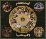
The BRCP’s research has also gone the other way. The team discovered that two paintings attributed to Bosch, Christ Carrying the Cross and The Seven Deadly Sins are likely the work of followers, not the artist. Macrophotography, x-radiography and infrared reflectography revealed that Christ Carrying the Cross that it was produced after 1525, nine years after Bosch’s death, and the painting style is dissimilar enough to make it unlikely that it was even made in his workshop. The Seven Deadly Sins was exposed by its underdrawings and overall quality as definitely not the work of Bosch himself, although it’s possible that it was made in the family workshop.

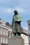
The Dutch city of ‘s-Hertogenbosch, commonly referred to as Den Bosch, birthplace, home and workplace of Hieronymus Bosch, is celebrating the anniversary year with a great many parades, concerts, games, theatricals, art shows, lectures and, for the December finale, “the lighting of the Bosch beast” in the city center which I haven’t been able to find a precise description of but sounds like the greatest Burning Man ever. The Noordbrabants Museum will hold a major exhibition of Bosch’s work. Hieronymus Bosch – Visions of Genius brings together masterpieces from top institutions in Europe and America, including the Metropolitan Museum of Art in New York, the National Gallery of Art in Washington, D.C., the Prado in Madrid, the Louvre in Paris, the Gallerie dell’Accademia in Venice and the Museum Boijmans Van Beuningen in Rotterdam. For the first time, a majority of Bosch’s works will be together on public display in the city where they were painted. Artworks include world-famous pieces like the Haywain Triptych and the Ship of Fools, as well as virtually unknown works like the newly authenticated Infernal Landscape drawing and 12 panels recently restored by the Getty Foundation’s Panel Paintings Initiative which have never been on view to the public before. The exhibition runs from February 13th through May 8th, 2016.

Den Bosch was founded in the 12th century a fortress city and much of the historic center has survived intact, including the complete medieval ramparts that encircle the old town. It was spared from destruction in World War II and spared from even worse destruction by well-meaning modernizers after the war thanks to the city council’s quickly declaring the entire old city a protected historical townscape before the first rampart could be felled or the first canal filled. That means if you take one of the special Bosch Experience tours available from March to November of this year, you will be seeing things he actually saw, walking the same winding roads he walked, visit the same places he worked and lived.

[youtube=https://youtu.be/CxuhuTtXHfg&w=430]

All of the research and analysis the BRCP has done over the past six years will be published in a two-volume monograph later this month. There will also be a website, funded by the Getty Foundation, where all the BRCP’s research and images will be available for our rapt perusal. It’s set to launch before the opening of the Noordbrabants Museum exhibition but there’s no url yet. I’ll update when the site goes live.