 The UK National Archives have uploaded hundreds of pictures of colonial-era Canada just in time for Canada Day. On July 1, 1867, the British North America Act (known in Canada as the Constitution Act since 1982) united the colonies of Nova Scotia, New Brunswick, and the Province of Canada into a federal dominion of four provinces. Nova Scotia and New Brunswick remained the same; the Province of Canada was divided into Ontario and Quebec.
The new Confederation would retain the monarch as head of state, but would have a self-governing bicameral parliamentary system and, most appealing to Britain, it would fund its own defense. The removal of British troops and new political distance from Britain would help improve relations with Canada’s grumpy neighbor to the south which was nursing fresh grudges over Britain’s support for the Confederacy in the Civil War, and which would spend the rest of the century gobbling up new territory in the name of Manifest Destiny.
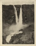
 The pictures come from the Colonial Office’s Photographic Collection. There are 12 sets of pictures, from a collection taken during the Prince of Wales’ (the future Edward VIII who abdicated to marry Wallis Simpson) 1919 tour of Canada, to regional collections depicting grand natural vistas and the minutiae of daily life. You’ll find some of the first photographs ever taken of Canada in the 1850s buried in the sets, along with classic 1960s advertising from the National Film Board of Canada. You’ll also find a lot of First Nations misery documented, and some unpleasant period terminology like “half breed.”
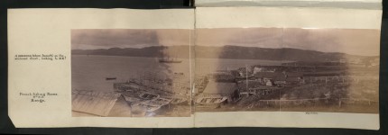
The Newfoundland and Labrador set captures fishing villages from the late 19th century, including a remarkable 1892 panorama of French fishing rooms in Cape Rouge Harbour. Fishing rooms were waterfront locations where all the facilities necessary to trap, process, salt and store the catch (mainly cod) were built, along with dwellings for the workers and their families.

There are also some fascinating diagrams of the equipment they used and ground plans for factories, homes, and warehouses.
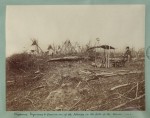
 The Canadian Border set documents the expedition to map the boundary between Canada and the United States from 1872 to 1876. It was a joint project by participants from the United States Northern Boundary Commission, Royal Engineers from the British North American Boundary Commission, Canadian First Nations and Native American scouts, scientists, astronomers, cartographers, soldiers, ambulance teams, ox and mule teams and the teamsters that drove them.
  The pictures convey how isolated this longest continuous boundary between two countries was even decades after it was formally drawn at the 49th parallel.
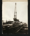
To go from that set to the industry of 1910s Quebec, or to the urban residences and dawning consumer gadget era documented in the Domestic architecture, 1920s set, or to the 1890s canal cuts and 1920s wheat fields of Alberta is like hopping through alternate dimensions.
Happy Canada Day!